Sunday, June 27, 2010

How To Digitize Vegetation and Land Layers using Landsat Imagery at 1:12,500 Scale

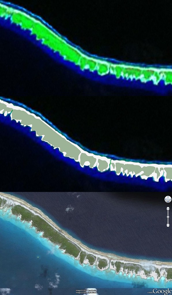
Faaite Atoll FP - Comparison - Landsat Image, EVS Precision Map, DigitalGlobe Image (1-12,500)

Faaite Atoll FP - Comparison - Landsat Image, EVS Precision Map, DigitalGlobe Image (1:12,500)

I keep telling all of you that I typically digitize off of Landsat imagery at approximately 1:12,500 scale. Checking out the above montage you will see a Landsat image of a portion of Faaite Atoll FP. Beneath it are two layers of information I digitized using Landsat as base imagery, vegetation and land. The final DigitalGlobe image from Google Earth is of the same stretch of atoll. The Landsat image has a green hue over all of the land and vegetation features. However, having digitized so many islands the sand or low vegetation, which I classify as land is identifiable. My Landsat derived vegetation layer is a decent approximation based on the vegetation shown on both Landsat and DigitalGlobe's hires imagery. The digitized land layer, I believe, is a strong match.

Why should one care at what scale one is able to digitize using Landsat as base imagery? Ask any photogrammetrist and they will tell you Landsat is reliable between 1:125,000 to 1:62,500. Each pixel covers a ground area of 14.5 meters by 14.5 meters. However, working at 1:12,500 does not render an image useless, but allows one to discern details in a rough but usable fashion. I can't make out individual trees, but I can identify stands of vegetation and most often the density of that vegetation. The most difficult feature on an atoll to reliably digitize is that portion of the reef which is awash depending on the time of day (high tide or low tide) and the amount of vegetation found growing on the reef. It is often difficult to determine whether the feature is above water land or below water shallow reef. Typically, if I'm uncertain I classify the feature as above water land.

Who knows, one day you might want to try your hand at island map making and you will want advise as to what scale you might expect to work at using Landsat as your base imagery. Digitizing at 1:12,500 should work just fine. Give it a try.
Saturday, June 26, 2010

Tepoto Nord FP - A Redo of a Redo of a Small Coral Island

Tepoto Island FP - Image

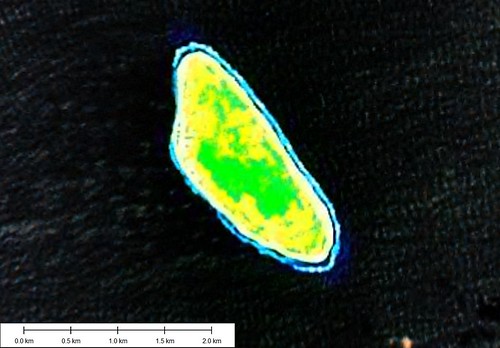
Tepoto Nord FP - Landsat Image from S-07-10_2000 (1:20,000)


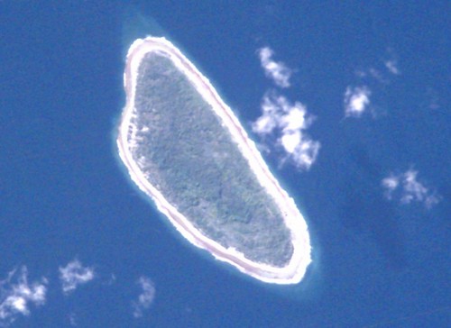
Tepoto Island FP - ISS002-E-8862

Tepoto Nord FP - ISS002-E-8862 Image


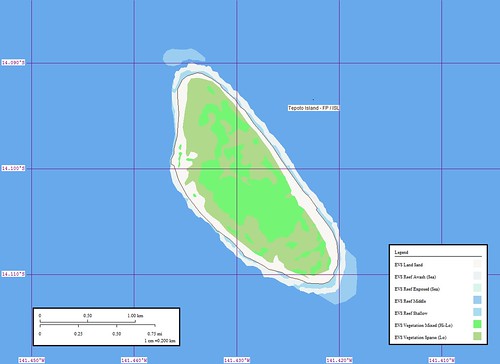
Tepoto Island FP - Map

Tepoto Nord FP - EVS Precision Map (1:20,000)

My first map of Tepoto Nord was completed on March 31, 2006. I used Landsat as my base imagery. Most of my finish work was done using Marplot, a fine poor-man's GIS program. In December 2006 , I came upon the ISS image of Tepoto Nord. I decided to redo my original work using the ISS imagery to digitize from.

I look at my completed Tepoto Nord mapping project today and contemplate how far my map making skills have progressed. My digitizing of shorelines, vegetation and reefs remains fairly consistent. I routinely work at between 1:12,000 to 1:8,000, depending on my base imagery and the ultimate objective for my map. I am content to map four to five layers of information taking what Landsat is able to provide. The first time I mapped this island, I remember being frustrated by the Landsat imagery. The odd colors and blurred appearance of the island made digitizing problematic. Eventually, I came upon the ISS image and was able to redo my mapping of this small island in a more satisfactory manner. I reposted the map and base imagery in December 2006 and gave this small island no more thought.

That is until I received a question from an EVS Islands reader. He wanted to know everything he could about this small island. I answered that he should contact Alex W du Prel, publisher of Tahiti-Pacifique magazine. If anyone could give information about this small island, Alex is the man. After answering the reader's question, I checked out my map of the island. Unsatisfactory! The map presentation choices I make today are far superior to those I made in 2006. I decided to redo my redo of this small coral island.


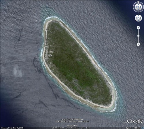
Tepoto Island Nord FP - DigitalGlobe Image from Google Earth (1-12,000)

Tepoto Nord FP - DigitalGlobe Image from Google Earth (1:12,000)


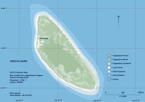
Tepoto Island Nord FP - EEVS Precision Map (1-12,000)

Tepoto Nord FP - EEVS Precision Map (1:12,000)

I checked out Google Earth, as almost all of the islands within the Tuamotus are covered by DigitalGlobe's hires imagery. Sure enough, Tepoto Nord has excellent, cloud-free imagery from which I could redigitize various layers of information with a high degree of confidence. Seven layers of information later my redo of the redo is done. Since I have no designs to offer the map for commercial purposes, I decided to use DigitalGlobe imagery as my base imagery. I have worked on this redo of a redo for about two weeks. Not because it was particularly difficult, but I've been busy with school. Finally, I have a Saturday with no pressing projects. Only this, to finish my Tepoto Nord FP map. Pretty nice, huh?

Enjoy!