I receive numerous requests for special project maps. Most of them I do, a very few I don't. Lately, representatives from non-profit groups have solicited my map-making talents to construct maps and secure imagery for their special projects. Their budgets are $0.00 for mapping. If the group's work furthers the quality of life of both human and non-human (flora and fauna) inhabitants of these fragile places, I try to help. They begin by asking if I use ArcGIS. I tell them I too operate on a $0.00 budget and it is too expensive. They then ask "how I do what I do when I do what I do" in making my maps. So I explain my map making processes.
When I first began making maps, I used Landsat ETM+ mosaics exclusively. They enabled me to create detailed shorelines, where none had existed before. I made lots of maps using this database of imagery. Then came Google Earth and then came DigitalGlobe hi-res imagery. Many of my current projects use this imagery for a base. It is how I use it that this post deals with.
(The following is the essence of an e-mail I sent to one of my non-profit contacts. It explains "how I do what I do when I do what I do" in making maps using DigitalGlobe hi-res imagery in Google Earth.)
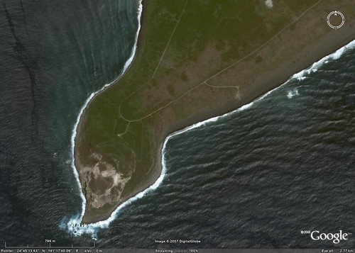
Iwo To - DigitalGlobe Image From Google Earth Detail Suribachiyama (1-12,500)
Capturing and georeferencing DG imagery can be done. Depending on the level of detail required, the number of images captured and georeferenced can be extensive. For example, a relatively small island I recently digitized required over 30 DG images taken from GE. One must be patient and practiced at creating mosaics from these separate images. I ensure all images are at the same scale on GE, systematically select and save them to my desktop,
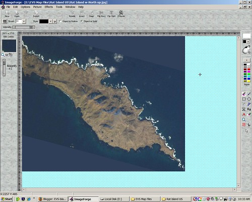
Creating a Photo Mosaic From Shuttle Images using ImageForge
and then create a mosaic of images in a draw program (ImageForge).
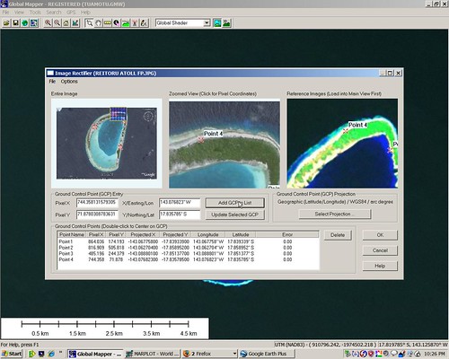
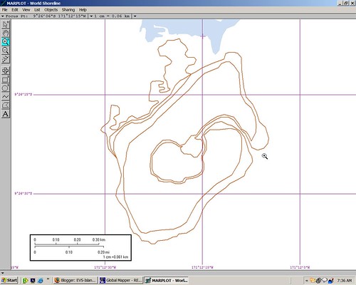
DG Image Georeferencing in Global Mapper
I take these mosaics and georeference them using my preliminary mapping program (Global Mapper), where I do the bulk of my digitizing.
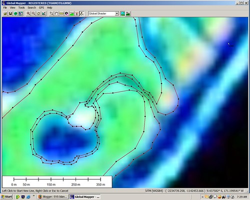
Digitizing from Landsat ETM+ Image using Global Mapper
As I complete digitizing areas of interest from these base images, I import the vector files into my primary mapping program (Marplot),
Making Maps using Marplot
where I create my maps.
******************************
Another process, much simpler, but still challenging,
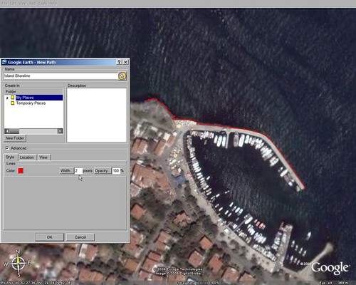
Digitizing using Google Earth tools
is to digitize island shorelines and information layers using GE's path and polygon capabilities. Both of these digitizing tools are extremely powerful and flexible for the type of mapping I require. After digitizing a number of layers of information, I process the KML file into a simple ASCII vector file and import them into my preliminary and primary mapping programs where I create maps from these GE-derived vectors.
******************************
Both methods have taken me over two years to master, but the end-product is cool!
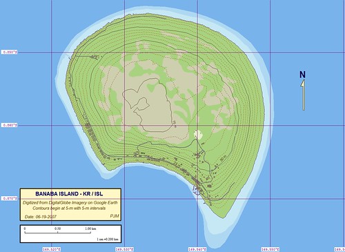
Banaba Island - Marplot Map with Contours (1-20,000)
I am an accomplished map-maker when it comes to using DG/GE imagery. I currently work with two university-affiliated non-profit organizations supplying maps and images for their island projects. My maps have been viewed by over 25,000 visitors this year alone. Most are arm-chair travelers. However, a substantial group represents a "Who's Who" of the GIS community and the business community using GIS in their work.
My map-making processes can be taught to the right students. Given time (months), genuine enthusiasm (you have to love the map-making process and the final product), an aptitude for monotonous work (digitizing and tweaking the project) and the ability to constantly improve your map-making skills, I could teach someone, with these attributes, how to make maps of islands. Or, I could make your island maps myself. Whatever.(And that is what I said about me and my maps. Interesting, huh?)
Enjoy!