Tuesday, September 25, 2007

Data - More World Port Data From Carlos Tibbetts

Carlos J. Tibbetts
Government Employee, Retired Military,
Data-Dude Extrodinaire


Korean Port Data

Korean Port Data

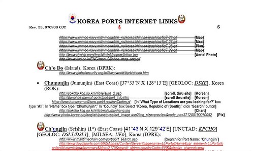
I came across Carlos about a year ago. Actually, he came across EVS-Islands and liked my efforts and offered his unique data sets. It seems Carlos likes to collect and share world port data. Specifically, he likes to collect links to ports. He maintains a port database that makes the World Port Index pale in comparison.

He offers his data, typically in PDF format, to any and all. He will place you on his mailing list and periodically send you updated information on ports. I just received African Ports and Korean Ports.

To my knowledge, Carlos does not have a website, but will ensure you receive his World Port data via e-mail. Drop him a line and let him know that Mr Minton at EVS-Islands aimed you his way. He will take care of your port needs. The following link is his email address.

Carlos J Tibbetts

Enjoy!

Saturday, September 22, 2007

Pulau Reong ID - A Primitive Tropical Forest

Pulau Reong - GE Locator

Pulau Reong - Google Earth Locator


Pulau Reong - DigitalGlobe Image from Google Earth (1-12,500)

Pulau Reong - DigitalGlobe Image from Google Earth (1:12,500)


Pulau Reong - EEVS Map (1-12,500)

Pulau Reong - EEVS Map (1:12,500)

This island map has taken about 2-hours from start to finish. The most difficult aspect of digitizing it was how to handle the western portion of the island. I elected to use Landsat N-51-05_2000 imagery to complete vectors for the western portion of the island. The majority of the work was done in Google Earth using DigitalGlobe (DG) hi-res imagery.

This island interests me for what it doesn't have. As I studied the DG imagery I cannot find any human signs - no village, no house, no plantation, no large areas of bare earth. It seems that this island's primitive vegetation layer, which is heavily forested, is intact.

I would love to explore this island. Could you image moving through the forest and encountering the flora and fauna within this pristine environment. White sand beaches are found along much of the shoreline. Although the island gets heavy rainfall, there are no visible swamps or mosquito-laden wetlands.

Now back to reality, The island is probably full of bugs, small and large critters. It probably has reptiles named Deadly Five-Pacer. You know, five paces and you're a gonner. Any time you see a tropical forest, the area is innundated with rain and subject to blistering high humidity.

How negative! The explorer in me would love to visit this island. The practical city-dweller, he would still like to visit, but with mosquito nets, raincoats and snake bite kits.

Enjoy!

Wednesday, September 19, 2007

Balesin Island RP

Balesin Island - Location Google Earth Map

Balesin Island RP


Balesin Island - Landsat Image N-51-10_2000 (1-31,250)

Balesin Island - Landsat Image N-51-10_2000 (1:31,250)


Balesin Island - EVS Marplot Map (1-31,250)

Balesin Island - EVS Marplot Map (1:31,250)

I don't purposely work on islands that have "claim's to fame", but all of the ones I have worked on seem to have interesting stories to tell. Balesin Island is no exception. Seems this small island is the location of a high-class resort. You and 40 of your friends can enjoy the miles of sandy beaches. Just pony up $85 per room per night and transportation to the island. Your accomodations are top rate. The service is exquisite. Everything is first class.

I was going to say something silly, but I won't. I have never been to the island, but one of the websites that sells the islands attributes makes it look great. Now, alittle about why I mapped it.

One of my students wants to become a cartographer. During my lunch time, I showed her how I go about making an island map. Since I had this Landsat image loaded on my computer at school, I slected a small island, Balesin Island. I showed her how to digitize a shoreline and the various layers of additional information that I would map to complete this project. I estimated that this project would require an additional 4-hours of work. It has taken about 6-hours to complete. Tomorrow, I'll share this completed project with my aspiring cartographer. Hopefully, she will remain inspired.

Enjoy!


Monday, September 17, 2007

Ostrov Tyuleniy RS

Ostrov Tyuleniy - Google Map Locator

Ostrov Tyuleniy - Google Map Locator


Ostrov Tyuleniy - Landsat Image N-38-40_2000 (1-50,000)

Ostrov Tyuleniy - Landsat Image N-38-40_2000 (1:50,000)


Ostrov Tyuleniy - EVS  Map (1-50,000)

Ostrov Tyuleniy - EVS Map (1:50,000)

This Caspian Sea island is off of the coast of Dagestan. I have been digitizing this island for the past week. It was a fairly complex project due to the marshland that makes up much of the island. My research uncovered reports on Tyuleniy birds, insects, fish and crude oil exploration. The crude oil exploration was conducted back in 2005 by the German company Wintershall. Turns out they are one of the big players in the world of oil. They are working with Russian groups to explore this potentially oil rich region in the Caspian. My look into Wintershall's website did not uncover any additional information.

I like my map. It looks good and is as accurate as Landsat imagery allows.

Enjoy!