A few days ago I received an email from a reader wanting to know the location of an uninhabited island far removed from the "cares of man". Actually, the person desires a habitable island that is currently uninhabited. In addition, it should be so far off the beaten track, no one visits it, ever!
I haven't answered the email directly, but I will answer it in this post.
Some Challenges of Living on an Uninhabited Island
You must have water! Three to five days without it and you are gone. On islands with vegetation, water does exist, most often in a fresh-water lens, a fragile structure that traps fresh water amidst sea water and rock. Since water is the most critical element for human survival, one must locate and tap into this water source and hope that it is stable (no mixing with sea water) and of sufficient size and quality to supply potable water at a rate necessary to sustain human, animal and flora life. Another source of water is rainfall. Of course one would develop their own rainwater catchment basin to collect nature's falling waters. To be completely safe, a portable saltwater to freshwater conversion device would be handy.
Once you have water, you need shelter and loads of shelter making tools. A shelter should allow one to escape the elements, when necessary. It should provide a secure resting place away from the creeping, crawling, buzzing and walking critters. It should keep you dry during rain and be a comfortable place to read a good book.
Food is next up. Your diet will be opportunistic - non-poisonous fish, coconuts, taro (if possible), breadfruit and any other edible plant or animal found on your paradise isle.
Learn how to make you own clothing. It is less about modesty and more about protection from the elements. If you really dig the "leather skin" look, minimal clothing will suffice. If you are an anti-skin cancer person, clothing and an umbrella are a necessity.
Let's see, we have water, shelter, food and fashion taken care of. How about medical attention? If you are off the beaten track, you become your own doctor and your own medical supply source. Try to account for every medical eventuality that might occur on your coral surrounded island home (and know that you won't) and supply appropriately. Be careful! If you are alone, a small "boo boo" can turn into a major medical problem fast. Know how to treat those common medical problems so that you can live a quality existence on your tropical isle.
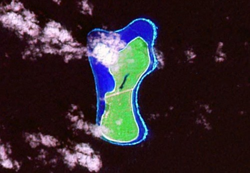
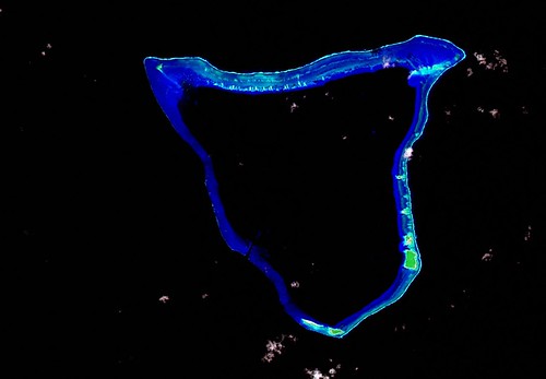
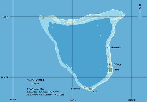
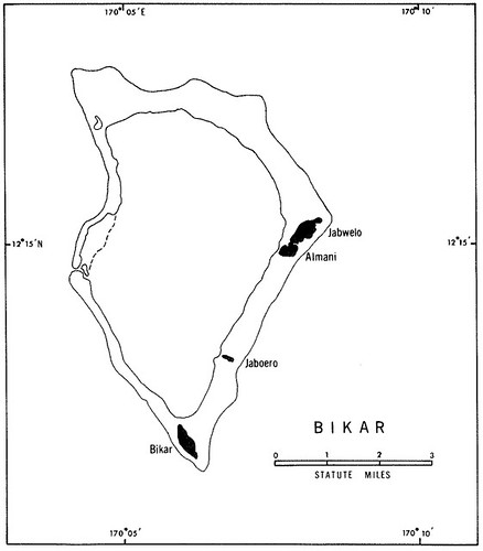
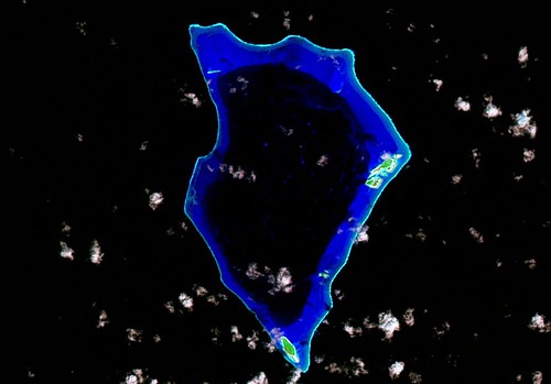
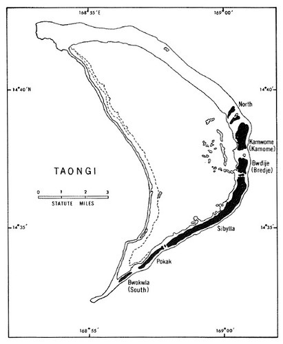
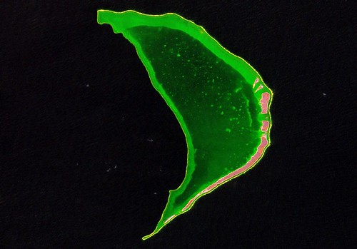
Taongi Atoll - EVS Precision Map (1:110,000)
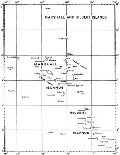
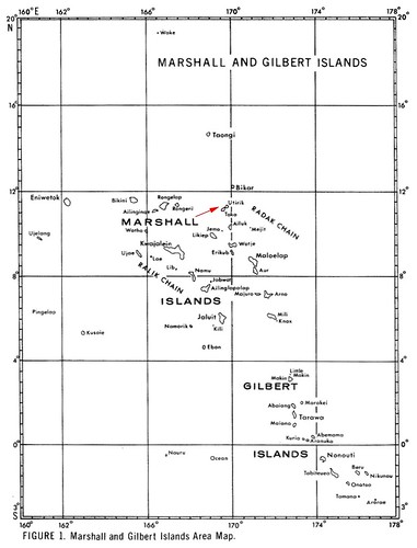
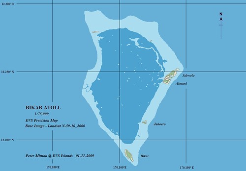
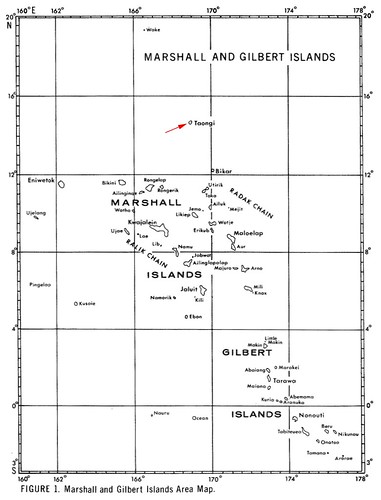
Let's discuss the merits of two types of uninhabited islands. The first and perhaps most romantic is the coral atoll. Taongi Atoll is uninhabited today. It is a possession of the Republic of Marshall Islands. It is located in the Radak Chain at their northern extreme. It is off the beaten path. The land area is of sufficient size to allow many, let alone one, to live in reasonable comfort. The weather is Pacific-balmy many months out of the year. When rain falls, it is enough to feed it's freshwater lens and should be of sufficient quantity to capture in your rainwater catchment basin. Taongi is covered with vegetation, which consists of native and non-native flora. One of your most important flora being coconut palms for food and shelter. It is a low island, not more than 5 to 10 meters above sea level. A good storm surge would swamp the island. A catagory-4 typhoon would do loads of damage. However, the vegetation and it's appearance suggests that this island is frequently spared the ravages of typhoons. However, it is visited occasionally by RMI islanders to gather copra. Perhaps when they arrive, you could hide.
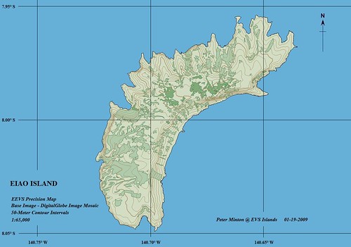
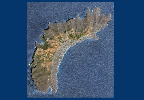
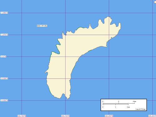
Eiao Island - EEVS Precision Map (1:65,000)
Or you could head to Eiao Island. It is located at the northern end of the Marquesas. It is 8 x 3-miles and has an elevation of 500-meters plus. Is was inhabited, but is no longer. The island is overrun with feral animals (rats, goats, sheep, pigs, cattle and a few horses) and they eat the vegetation to the point of extinction. The island has a freshwater spring. The amount of standing vegetation suggest ample rainfall. This island is subject to droughts, so a freshwater catchment basin is a necessity. The same fundamental living challenges apply to a high island as they would to living on an atoll with one exception, the occasional typhoon will blow your house down and level trees, but you should survive as no storm surge will reach this island's heights.
Would I Want to be the Only Inhabitant on My Own Island?
When I was younger, yes, most definitely. I absolutely knew I could not only survive, but I would thrive. Now that I'm a mite bit older, I would still like to go, but with a large amount of the comforts of civilization along with a carefully selected group of friends and family. I won't share my list of "must-haves", but know that my shelter would rival that of the Swiss Family Robinson, the Disneyland version.
Enjoy!