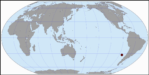
Robinson Crusoe Island CL
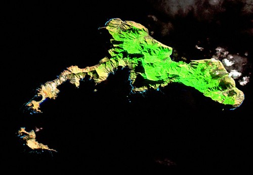
Robinson Crusoe Island - Landsat ETM+ S-17-30_2000 (1:85,000)
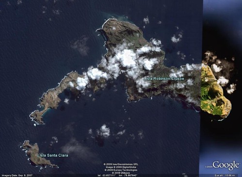
Robinson Crusoe Island - DigitalGlobe Image from Google Earth (1:85,000)
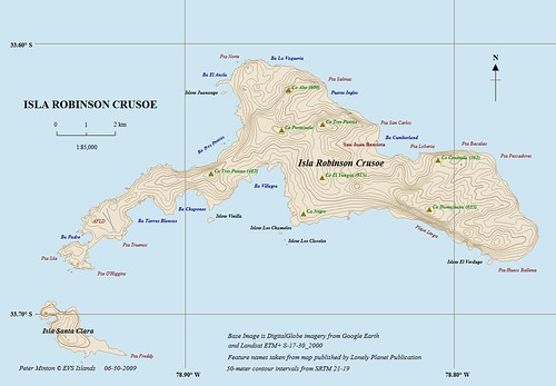
Robinson Crusoe Island - EVS Precision Map (1:85,000)
When This Old World is Getting You Down
At times we all wish we could pull a "Robinson Crusoe", find some forgotten spot, seldom visited, yet replete with all the necessities of life - food, water, clothing and shelter. A place without financial pressures, martial woes, busy urban scene and no threat of crime spilling into our fragile lives. I'm not sure that place exists. Alexander Selkirk, the individual Daniel Defoe based his Robinson Crusoe character on, was so lonely by the end of his four year exile, he gladly rejoined the crew of the individuals who had originally abandoned him. His life on previously uninhabited Isla Mas a Tierra was often wretched. His diet was life sustaining, but challenging to gather. His clothing was handmade and unkept. His shelter is reputed to be a cave. He spent many lonely hours at his lookout scanning the horizon for a ship that might rescue him.
With that said, we still wish we could escape to his place. We all know in our heart of hearts we would do better. We would not grow lonely, but using our 21st century knowledge and preplanning, our island life would be a special time to reflect on the world and all of its mysteries and how we fit into them. When we grow tired of our adventure, we would merely dial our satellite phone and be whisked away, back to our previous lives.
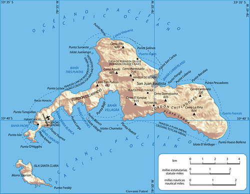
Robinson Crusoe Island - Wikimedia Commons
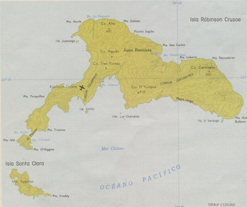
Robinson Crusoe Island - Source Unknown (1:120,000)
Two Other Maps
A map is seldom an entirely unique creation. Robinson Crusoe Island has been mapped many times. Some of these are excellent compositions. I used two other maps to aid in the construction of my map. The first one, found in the Wikipedia article on Robinson Crusoe Island was used to gather feature names. The second map, source unknown, was used to confirm certain feature names and supply any new ones not found on the first "helper" map.
The vector files making up my EVS precision map were created using Landsat ETM+ and DigitalGlobe from Google Earth. The majority of the shoreline was extracted from DigitalGlobe imagery. Where clouds obscured the land, I used Landsat to map the underlying area. The 50-meter contours were derived from SRTM data. There is a problem with the elevations, some of the higher elevations are dramatically different than what they should be. El Yunque Peak is supposed to be 913-meters, but is shown to be approximately 650-meters using SRTM data. I did not correct the erroneous elevations in this version of my map. Perhaps, I'll correct them later.
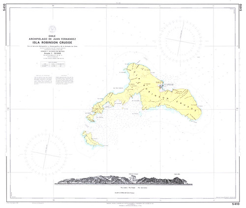
Robinson Crusoe Island - Chilean Nautical Chart 5410 (1:50,000)
Finally, for all of you sailors that wish to explore Robinson Crusoe Island, the Chilean Hydrographic Office (SHOA) has a nautical chart you might wish to purchase. The above image is a copy of it.
Enjoy!
