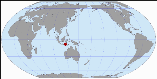
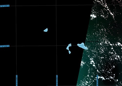
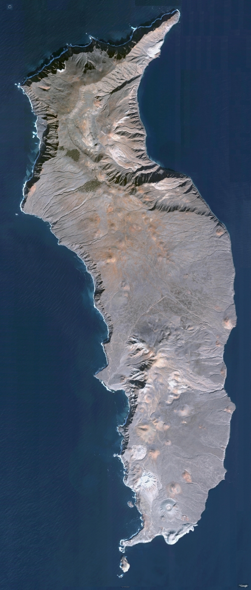
Komodo Islands, Indonesia
Bima, Indonesia (txu-oclc-21752461-sc50-4) Perry-Castañeda Library
Map Collection
Why Make Another Map of a Previously Mapped Island?
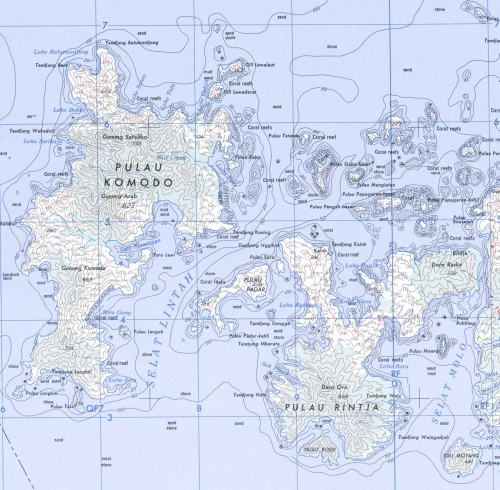
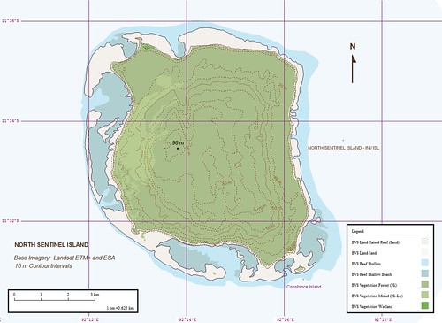
The highly detailed mapping for this group of islands is paper. I create digital maps. The paper map lives in a library map drawer. My digital map will be available for any person wishing to use it. The raster imaged map above is a US 1:250,000 scale topo created from aerial surveys conducted in the 1940s and 50s. The scale my finished map will be useful is between 1:50,000 to 1:125,000. My map will contain additional layers of information detailing types of vegetation and reefs. Plus, I just like to make island maps.
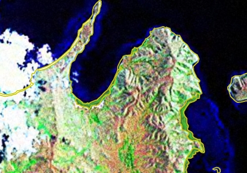
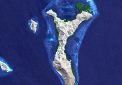
Komodo Islands - EEVS Precision Digitizing using Landsat ETM+ Imagery (1:20,000)
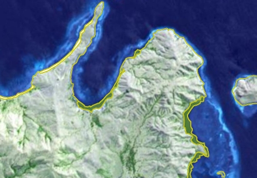
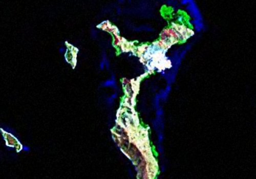
Komodo Islands - EEVS Precision Digitizing using ASTER Imagery (1:20,000) Credit: NASA/GSFC/METI/ERSDAC/JAROS and U.S./Japan ASTER Science Team
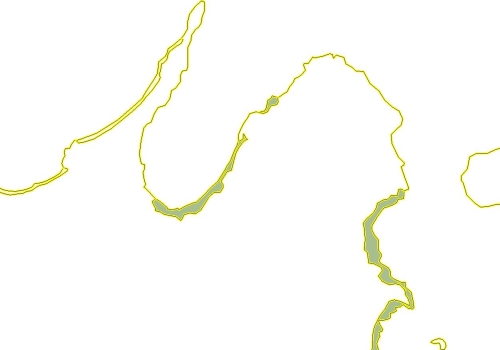
Komodo Islands - EEVS Precision Digitizing, Size Modified (1:20,000)
Better is Better and More Accurate is More Accurate
I love the ASTER imagery for this island group. It is extremely detailed and provides a cloud-free look at almost all of the islands within this group. One is able to get an excellent view of different types of vegetation - mangroves, dense forests and scattered brush. Comparing it to the Landsat ETM+ image, the ASTER image provides a greater amount of cloud-free coverage. Combining the two images, ASTER and Landsat, one is able to create a virtually cloud-free image of the Komodo Island group. In the tropics, cloud-free is unique. One challenge was the georectifying of the ASTER image to the Landsat ETM+ image. It took 27 unique ground control points to twist, stretch and tug the ASTER image so that it precisely overlay the base Landsat image. Once that task was accomplished, I got around to digitizing layers of information. My first layer is always the island shoreline. Then comes all of the additional layers. I have completed the beaches and an inland vegetation layer at the northern end of Pulau Komodo and am currently working on the mangrove forest layer.
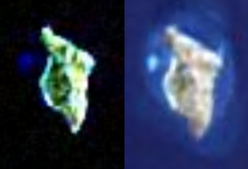
Pulau Siaba Besar and Kecil Islands - Landsat ETM+ Image (1:20,000)
Pulau Siaba Besar and Kecil Islands - ASTER Image (1:20,000
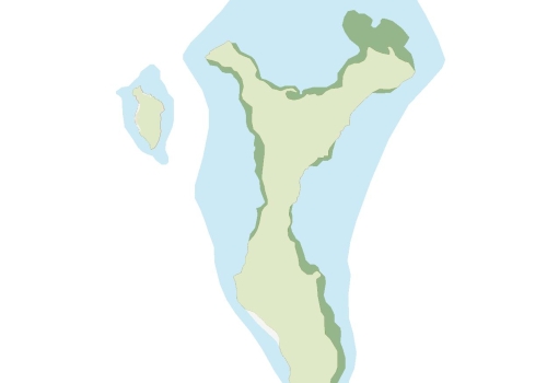
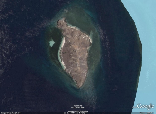
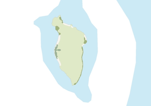
Pulau Siaba Besar and Kecil Islands - EEVS Precision Map, Preliminary (1:20,000)
Mapping at EEVS using ASTER Imagery
The above map is an example of the level of detail one can extract from the ASTER image. Those dark green areas along the island's shore are mangrove forests. Interestingly, these mangrove forests seem to primarily form along the eastern shores of the islands. This would be where the water is less turbulent.
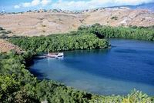
Komodo Islands - Mangroves
The vegetation layer identified as EVS Vegetation Wetland, mangrove forest, detailed on the Pulau Siaba Besar map above, would look like the above image, dense dark green foliage along the shore. The dense dark green foliage that one sees inland will be classified as EVS Vegetation Forest (Hi). As you can see from the above image, much of the land is sparsely covered with vegetation. I have identified that layer as EVS Vegetation Scattered, which will include low lying grasses and small bushes.
Comparison - Landsat ETM+ to ASTER Images (1:5,000)
Pulau Siaba Kecil Island - DigitalGlobe Image from Google Earth, Size Modified (1:5,000)
Pulau Siaba Kecil Island - EEVS Precision Map, Preliminary, Size Modified (1-5,000)
Mapping at Scales Between 1:1,000 to 1:2,500 Using DigitalGlobe Imagery
In a perfect world, maps created from DigitalGlobe imagery found in Google Earth would be owned by their map maker and that map maker would be free to use that map anywhere and anytime they wished. No restrictions. No ownership delimmas. Just a map one would be free to use as one sees fit. But this world isn't perfect and DigitalGlobe and Google Earth have stern restrictions on how one is allowed to use their imagery. Pulau Siaba Kecil EEVS precision map was constructed off of DigitalGlobe imagery found in Google Earth. I am able to post my map, but there are restrictions on how I might use this map further. With that said, let's move on.
I decided to experiement using DGs hi-res imagery found in GE. I have used their mapping tools before and found them easy to use, intuitive and flexible. There are drawbacks, but one can work around them easily. The DG imagery allowed me to digitize the dense vegetation along the island's western shore. I have mixed feelings working with hi-res imagery. It is the best for extremely accurate work, but sometimes it is too much. If you aren't careful, you can find yourself digitizing the location of individual trees or offshore rocks. That is overkill for my maps.
All other mapping within the Komodo Island group will be taken from ASTER or Landsat ETM+ imagery. A variety of vegetation layers will be used, along with at least two reef layers. All of the islands are outlined and I am currently working on vegetation layers for Pulau Komodo. Wish me luck and...
Enjoy!


