Wednesday, May 27, 2009

Thoughts - DigitalGlobe Imagery in Google Earth and Island Mosaics

Guadalupe Island - DG from GE (1-15,000) Small

Guadalupe Island - DigitalGlobe Mosaic from Google Earth (1:15,000)

I have been gently reminded, agressively scolded and accused of being an image thief. I appreciate the gentle reminders that DigitalGlobe imagery found in Google Earth is still the property of DigitalGlobe, yet is shared with all of us via the Google Earth platform. Let me explain.

A few years back as DigitalGlobe imagery began appearing in Google Earth, I did what many viewer did, I saved copies of high-resolution images of features I found interesting. My dilemma was my interest in islands, which most often require a number of images mosaicked together to create a detailed view of the island that I could then use to create my island maps. After creating my first DigitalGlobe high-resolution mosaic of an island with imagery taken from Google Earth I made my first phone call to Google Earth. I explained how I constructed my high-resolution base image using DigitalGlobe imagery found in Google Earth. I further explained that I used the georeferenced mosaic as my base image from which I would produce an island map for non-commercial purposes. A map that I would post to my website, EVS Islands. In addition, I would also post the mosaic to show readers my base image from which I produced my map. The magic word was "non-commercial". The gentleman I spoke with said that as long as the map was for non-commercial uses, Google Earth had no problem with my efforts, as long as I credited them when appropriate. He added, as far as the DigitalGlobe imagery was concerned, I needed to speak with them. Even though Google Earth hosts the imagery, I needed DigitalGlobe's okay to use their imagery as I was using it. So I called DigitalGlobe.

The individual I spoke with listened to my explanation of how I wanted to use their imagery. The "non-commercial" use of the imagery was again a key element of my intended use. I carefully explained how I took a series of DigitalGlobe images from Google Earth, mosaicked them, georeferenced the finished mosaic, digitized my vector layers of interest and finally posted both my finished map and an image of the DigitalGlobe high-resolution island mosaic to my website. He asked to see my map, the DigitalGlobe mosaic and the image of the mosaic. I emailed them to him. He checked them out and talked with his people. He emailed back that as long as my work derived from their imagery was for non-commercial purposes and I credited them as a source I was good to go.

It has been over two years since that first conversation. I have had a number of subsequent conversations with DigitalGlobe representatives concerning my use of their imagery. They have consistently advised that my use of their product and the crediting I give is acceptable.

Currently, I seldom use DigitalGlobe imagery to construct my island maps. I, almost exclusively use Landsat ETM+ as my base imagery. I hold out hope that somewhere, someone just might want to purchase my enhanced vector shoreline precision maps. So far, it is a "no go", but I hold out hope. In the meantime, I continue to admire the excellent high-resolution imagery made available through the joint efforts of DigitalGlobe and Google Earth. And if and when I need that high-resolution image of a large island, I'll go ahead and construct a DigitalGlobe image mosaic knowing that, so far, both Google Earth and DigitalGlobe representatives have given me the "okay".

Enjoy!

P.S. - Each use of DigitalGlobe's imagery found in Google Earth should be discussed with their representatives. They will determine the actual or potential impact upon their business. Be up front with them, giving a complete description of how you will use their imagery. My experience is that they will support most, not all, non-commercial uses of their imagery copied from Google Earth. The same goes for Google Earth. The problem comes in locating the right person to render a decision concerning your use of their product.

Friday, May 22, 2009

Thoughts - Continuing Yesterday's "Wow"!

Four Layers Loaded into Google Earth

Arutua Atoll - Four EVS Precison Layers Loaded into Google Earth

A reader of EVS Islands suggested that I load my island maps into Google Earth. He had taken the Flickr image of Arutua Atoll and created a Google Earth overlay. He did all of this work by manually matching the EVS image to the GE base image. After viewing his work I had another Wow! moment. It turns out Global Mapper creates KML/KMZ files. I have generated GE KML/KMZ overlays previously, but I thought I would try something different. Using the Arutua Atoll vectors, I created a separate overlay for each vector layer using PNG image format's transparency function. I began with my Reef Shallow and the ocean as my first layer without any color transparency.


Base Layer Loaded Reef Shallow with Ocean

Arutua Atoll - Base Layer Reef Shallow with Ocean (1:75,000)

The other three layers would rest atop this base layer. The next three layers were EVS Island Polygons, Vegetation and Inland Water. I made the blue ocean the transparent color for these layers. This resulted in overlays consists of 12 georectified tiles per layer neatly positioning an EVS precision island map into GE.


Four Layers Loaded into Google Earth at 1-75,000

Arutua Atoll - Four Layers Loaded into Google Earth (1:75,000)

Loading these four layers in proper order (Reef Shallow, EVS Island Polygons, Vegetation and Inland Water) one is able to switch layers on and off to view this atoll from a number of unique perspectives. Pretty cool!


Arutua Atoll - Four Layers in KML

Arutua Atoll - Four Layers in KMZ Files

I have posted the four layers and you are welcome to download them and try them out. They are at the following links: Reef Shallow, EVS Island Polygons, Vegetation and Inland Water. Remember to load Reef Shallow first, EVS Island Polygons second, Vegetation third and Inland Water last. The map is at a scale of 1:75,000. That allows you to view the map at the 4.00 kilometer center read using GE's scale bar. If you take the map below that scale it begins to get ugly fast (blurred lines and colors). Hope you find it interesting. Comments are appreciated, especially KML/KMZ types. I am certain there must be a way to load all layers within one KML/KMZ packet and still be able to retain the ability to pile layers on top of each other and exercise control over whether a layer is on or off. Thanks in advance.

Enjoy

Thursday, May 21, 2009

Thoughts - Wow! I Didn't Know Global Mapper Could Do That or Discoveries at 4:00AM

Arutua Atoll FP - EVS Precision Map From Landsat S-06-15_2000 (1-170,000)

Arutua Atoll FP - EVS Precision Map (1:170,000) - Upper Image


Atoll (1-75,000)

Arutua Atoll FP - EVS Precision map (1:75,000) - Lower Image

At first glance, except for a simple coordinate grid, use of a slightly different map scale and the addition of other necessary cartographic trappings, my original image of Arutua Atoll (upper) looks like the Arutua Atoll (lower). Although the images are both sized at 500 x 347 pixels, to fit into this web page, the two images are quite different. The upper image is JPG, whereas the lower image is PNG. I have been using PNG format images for my last few posts. Supposedly, they give one a better, sharper image at a much smaller size compared to JPG. Frankly, for what I am doing (posting an image of a vector map) the JPG format seemed to work fine. That is until I discovered my Global Mapper "Wow!".

I love my finished maps and enjoy sharing them with readers that appreciate my work. I believe most readers are often content to view an island image, read the brief article, ponder it and then go their merry way. As it should be. However, for the intrepid few that really want to check out the island map, that take the time to select the island image and view the original sized image in Flickr, have I got a treat for you!

If you select the lower Arutua Atoll image and follow it to Flickr, you will be able to view my original sized image of Arutua Atoll at a scale of 1:75,000. Global Mapper, my primary mapping software, allows me to capture a screen's contents to an image.


GM Image Capture

Global Mapper Image Capture

This is not a new discovery, as I have been using this option for years. But this morning I decided to changed the image size from a default of 1264 x 875 pixels to 2578 x 1750 pixels. This change transformed my 1:150,000 scaled island image into a 1:75,000 scaled island image. My original 1:150,000 scaled image will print on a standard 8.5" x 11" sheet of paper. To print my 1:75,000 scaled image would require a 21" x 14" paper. Within Flickr, the reader can view an image that more nearly displays the island at it's EVS precision viewing limits (between 1:75,000 to 1:50,000). Using Global Mapper to create my images, I am able to generate two additional files that allows one to view the island image with appropriate lat/lons (.pngw and .prj files).

My bottom line discovery - by varying Global Mapper's screen image capture size, I am able to quickly generate EVS precision island maps at meaningful viewing scales. And that's my 4:00 AM "Wow!"

Enjoy!

Wednesday, May 20, 2009

Thoughts - Atolls, Beautiful Daughters of the Reef

The following is an article written by Alex du Prel, publisher of Tahiti-Pacifique magazine. He offers it for your reading pleasure. Enjoy!


Atoll Beach

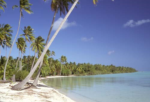
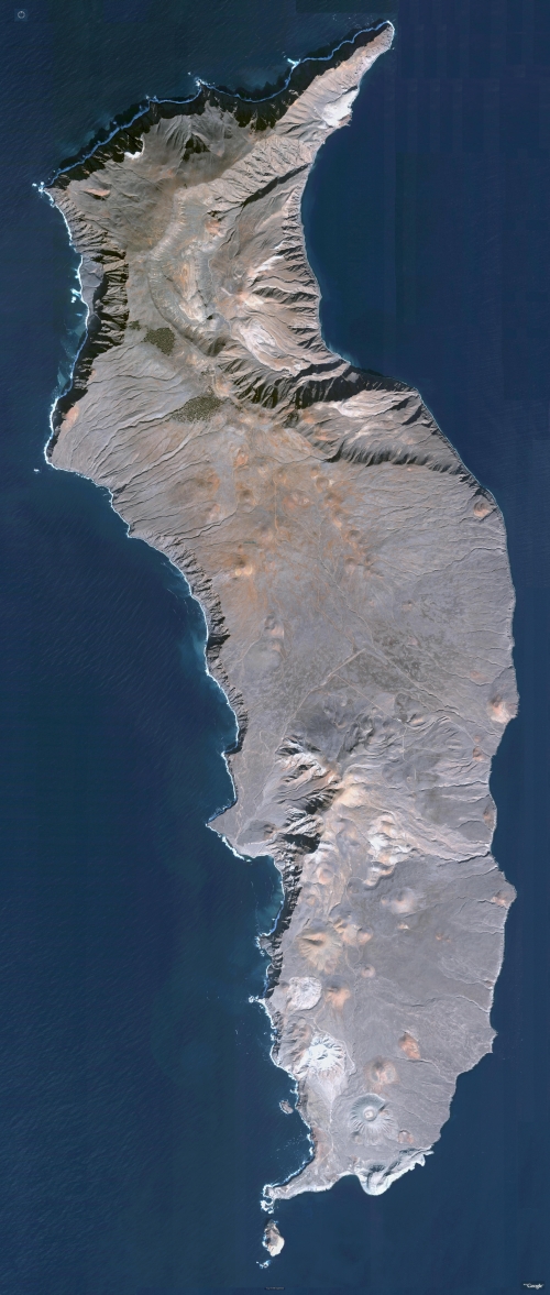
A beach landing area on an islet on Bora Bora's fringing reef (AKK_1731.jpg)

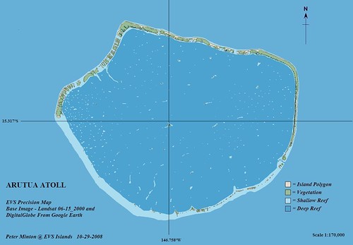
"I love reefs because that's what creates atolls.

I am a nut about atolls. I live them with passion. "Stupid you," say some friends, "How can you be crazy about a pile of sand?"

Well, maybe. But an atoll is a different universe. It's fragile jewel. A new world altogether. A place of intimate communion with nature. For it's the only land on earth created by life. By a living organism, coral. And it's a clean living sphere, so rare today, where you can even walk barefoot all day without ever having muddy, dirty feet.

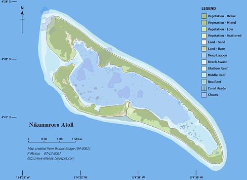
An atoll is not the result of the clashing of tectonic plates nor a piling up of some rocks. It doesn't erode, it grows. An atoll is the offspring of a secret pact between the noble elements of our planet. The fire of the bowels of Earth places the embryo; patience of time shapes it; water and sun nourishes it; the wind weans it.

Look at the Pacific Ocean. Huge. Vast, never ending. So vast. More than half our planet. Deep also, more than four kilometers deep, on average.

A small weak spot in the cold dark bottom of this endless blue water ocean. And the fire of genesis will slowly, patiently, step by step, push the magma up until, sometimes, it will breaks through the surface of the sea. This volcano then, a huge mass, from it's base to the sea level will be taller than the highest mountain on some continents.

The volcano will eventually run out of fire, will become extinct. Its weight, so massive and so lonely thousands of kilometers from any continent, will make it sink. Slowly. Inevitably. Erosion from rain and wind will help it disappear again below the sea.

But a small detail changes everything. Tropical polyps, the coral, will discover a perfect habitat on the slopes of that sinking mountain.

A solid base. A warm ocean. Lots of light, sunshine. And tons of oxygen provided by the endless surf produced by steady trade winds or storms in the far Roaring Forties.

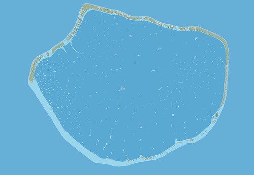
As the volcano keeps sinking, the coral will keep growing. Generation after generation on top of the calcium skeletons of their ancestors. Soon all trace of the volcano disappear - just a ring of coral will continue to grow and a lagoon will be born. An oasis of teeming life in warm tropical waters known to lack nutrients

The never stopping swells of the huge ocean will then cuddle this fragile jewel with loving care. Stroke it with its waves. Feed it with its oxygen. For centuries, ages, eons.
But nature, just like man, can turn momentarily insane, crazy, violent. Especially when it feels too hot. In its short folly it will try to destroy, maim, mutilate what it had nurtured with much patience, softness. This insane fit is called a hurricane, typhoon, cyclone, whatever.

Monstrous waves, like tremendous sledges, will then pound, break, smash the fragile and colorful underwater gardens. The nursing swell turned into a destructive ram will lift entire reef sections up, throw them on top of others; will grind coral and beautiful shells into sand.
Worn out, the ocean will quiet and expose a view of desolation in proportion to its short fury. On the wounded reef large mounts of debris will rot and stink in the reappearing sun.

A few years later, the rains will have rinsed the salt out of these new dunes. Sea birds will joyfully discover a new roosting place. Their droppings will provide nitrogen and seeds. A few years later the dunes will be green with bush, grass and other vegetation. Some coconuts will be washed on these new shores and will find a place adequate to take root.

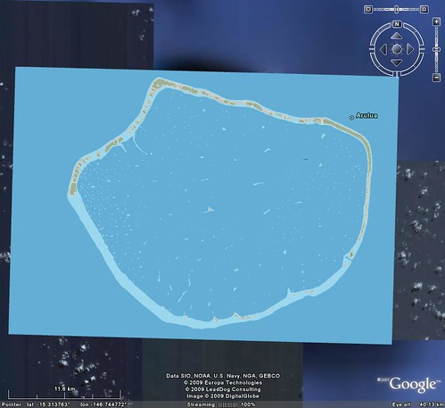
An atoll just has been born. An island consisting only of a sandy ring, one of these "islands full of water" with no trace of mineral soil. An island whose future entirely depends on the continuous growth of the reef. A reef which will repeatedly heal itself, continue to be the protective barrier for the fragile sand island and provide a never ending supply of new material. Without the ramparts made of billions of living polyps, the swell would just take one swallow of these storm leftovers.

There is all the ambiguity of an atoll : every time the weather has a fit, churns the ocean and tries to destroy it, this action only creates more debris that adds material to the atoll, providing more land. That's why an atoll, pure product of the reefs, is a living being that feeds on its environment, adapting to and thriving from its moods.
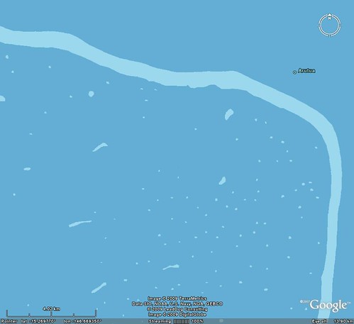
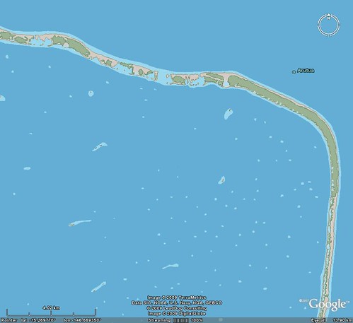
Lots of time will pass. Lots. Eternity. The fringing islands (motu) on the circular reef will get large enough to permit a fresh water lens to establish itself, which in turn will allow the growth of taller trees, like the coconut tree or the pandanus tree (screwpine).

Then, some day, some men, lost on the endless sea, crowded in a fragile outrigger canoe, will be washed onto these remote shores.
They will worship this life saving land. They will learn to survive, even prosper on these few and ever lonely acres. Learn to peacefully cohabit on it. They will figure out how to feed themselves, how to dress, how to heal with only coconut, fish, shells, taro and live that way for generations.

Actually, unless you are an absolutely stupid urban dude, you cannot die of hunger on an atoll. Beside the plentiful fish and shells that thrive in the lagoon, the lobsters on the reef (on moonless nights), there are coconuts and land crabs on the motus next to many other plants that can be eaten as salad or as a snack. Not to mention the many birds, and their eggs. To obtain fresh water other than the one in coconuts, one takes a big shell and digs a hole in the sand in the center of a motu, a meter or so deep to find the fresh water lens.

This reminds a story. I had the luck to be the manager of a small atoll (5 km diameter) with just a tiny hotel on it, De Luxe Robinson Crusoe style, with no other population.

One day, after a long walk along the beaches, we discovered on the other side of the atoll a sailing yacht laying wrecked on the barrier reef. On the beach opposite the wreck, a terrified family with two teenage children was camping. They were in rather poor shape, emotionally as well as physically. They had crashed onto the reef one night 10 days earlier and, poor navigators (that's before GPS existed), they thought being stranded on an uninhabited island. They had stayed close to the wreck of their yacht because that's where their (canned) food, and their water were. But one must admit they did manage to open and eat a few coconuts. Would they have been just a little more adventurous and only have crossed the motu to it's lagoon side (about 200 meters), they would then have been able to see in the evening, across the lagoon, the lights of the restaurant where one could order quite a fine meal, fit for Western taste with even a good wine, if you please.

An atoll is also a place where cultural shock do happen. Like this gentleman from New York. Instantly transported with no preparation from Broadway to primitive nature thanks to the speed of jet airplanes, he suddenly discovers in front of him the splendor of the lagoon and it's thousands of shades of blues and greens. Stunned, he walks (in his city shoes) to it's edge, cups up a handful of water, looks at it while it runs through it's fingers, tastes it and walks up to me;
-" Excuse me, Sir, may I ask a question ?
- Pllease do.
- Could you tell me what you put in the lagoon water to keep it so clear ?"
True, authentic, no joke!

Another time, a very blasé wealthy gentleman and his young secretary-mistress spent the week-end on the atoll. I take them by boat to one of the bird islands. Standing on an immaculate and long white sand bank, before a background of thousands of coconut trees beyond the shades of blue, with hundreds of birds flying around us while other stand lined up on the beach looking at us, I realize the gentleman is impressed. This makes me proudŠ until he says : "How much an acre ?" The secretary-mistress hit him on the head with her "Night of the Iguana" style umbrella.

Or this young very nice Italian of good breed who arrives for honeymoon with his fresh wife, a socially "active" girl. While the groom immediately fell under the spell of the atoll and it's peace, the lady realizes no one is there to be jealous of her wardrobe or to be impressed by her importance. Thus, all week long she complains about everything, continuously nagging her husband, typical syndrome of people who cannot bear to be alone with themselves (that's why bars have much business). When the couple leaves, the Italian lets his wife get aboard the small plane and tells me :
- "I'd like to apologize for her behavior." He adds , smiling : "Also, I'll be back soon, with another wife !"
I answer : "Great, but make sure you bring her here BEFORE marrying her !"

Permanently living on an atoll is a dream for a person who has the right mentality. But it also has it's risks. Just go to the "highest" spot on one of these atolls in the Pacific Ocean and stand there to admire the thousands of shades of blue waters in the lagoon. After being dazzled by such beauty, you might also look at your feet. It's then that you realize that this highest spot of the island is just a little pile of gray coral chunks, only 3 meters above sea level, next to the pass, facing the breakers of an endless swell curling along the barrier reef.
Now look to your right. Only ocean : 9000 kilometers of open ocean to the shores of South America. Look to your left : 7 000 kilometers of rolling swell to the beaches of Australia. Look behind you. 6 000 kilometers of stormy ocean till the icebergs of Antarctica. Look in front of you: another 9 000 uninterrupted kilometers to the Bering Straights, icy shores of Alaska and Siberia. You've just learned what isolation, real isolation, means.

Now think of these chunks of coral under your feet. You suddenly shudder. You just realized that it's the ocean that put the coral there. And that it can take it away just as easily. Three meters high in an ocean that spans half the planet is less than the tenth of the thickness of a cigarette paper floating in an Olympic swimming pool. Yep ! Andthe island is NOT floating.

A major cyclone. A tsunami created by some big earthquake in Chile, in Alaska or Japan. A major underwater volcanic eruption. A big meteorite falling into the sea. Any of these events can generate a wave that would just roll over this pile of broken coral, without even noticing, flushing into the open sea everything, sand, trees, shells and people. Everything. It has happened many times, and will happen again in one hour or in ten thousand years. Who dares say that guys like me who escape to these sand islands are cowards running from the reality of life ? This must be one of the most dangerous spots on earth. Living here is like playing continuous Russian roulette. But isn't risk the spice of life ?

Sometimes it can even get funny, unbelievable. Like getting flooded by fresh water, yes, fresh water, on an island surrounded by ocean, without a lake, a river, not even a tiny creek : It happens about every 20 years in the Tuamotu archipelago : a huge swell created by some major storm in the North Pacific arrived in the Northern Tuamotus, 8000 kilometers to the South, and raises the sea level to such a point that the freshwater lenses of the atolls get flushed up, out of the ground and inundates villages of many atolls.

But whatever, I'd rather be on an atoll.

©2009 Alex W. du PREL

Moorea, Tahiti
tahitipm@gmail.com

Published (in German translation) in "Mare Magazin", April 2009.

Monday, May 18, 2009

Por-Bajin - Republic of Tuva's "House of Clay" Island Fortress

Por-Bajin Wagner IV World

Por-Bajin (The square is supposed to be red. Go figure.


Por-Bajin - DigitalGlobe Image from Google Earth (1-3,500)

Por-Bajin - DigitalGlobe Image from Google Earth (1:2,500)


Por-Bajin - EEVS Map (1-3,500)

Por-Bajin - EEVS Map (1-3,500)

A map of an island fortress. Talk about romance, adventure and battles always won!

I read a brief article about Por-Banjin on World Island Info's website. This "House of Clay", the translation of Por-Bajin, is a hot spot for archeological research. Between 2007 to today, researchers and hundreds of students from Russia and a few other countries have made there way to this small island located on Lake Tere-Hole to attempt to understand and reconstruct this mysterious mandala like fortress. Follow this link to Ladybond's blog for an interesting series of photos of this small island.

My map of the island is based on DigitalGlobe imagery taken from Google Earth. I worked at a very large scale to digitize the various layers that make up the map. I show much more vegetation than the photos in Ladybond's blog shows.

This map is a preliminary cartographic sketch of the island, but one that clearly shows the curious Uighur fortress.

Enjoy!

Thursday, May 14, 2009

Thoughts - Just Do It!

Nikumaroro Atoll - Landsat Image S-01-00_200  (1-25,000)


Nikumaroro Atoll - Map


Nikumaroro Atoll - Image


Nikumaroro Atoll KR - Marplot Map (1-30,000)

Just Thinking About It

Back in 1964, I was checking out reference books at a library. I happened upon a Geographical Dictionary. Leafing through that dictionary, I came upon an entry describing a small obscure island, Eiao. The entry stated that this island was 8 miles by 4 miles with elevations of 3,000 feet in the island's central plateau. At one time the island was inhabited. During the later part of the 19th century, the French used the island as a prison. Now the island was overrun by feral animals which were decimating what little native vegetation remained.

From that single incident came my fascination with islands. Like many people with a keen interest in islands, my reasons are many and most of these reasons having nothing to do with geography (stress, explorer, master-of-my-domain, etc.). What I discovered early on was the absence of readily-available maps. There were a few WW-II maps in out-of-print books, but no available collection of island maps.

Scripps Institute of Oceanography and Maps

That led to Scripps Institute of Oceanography and their excellent map collection. SIO does ocean-oriented research throughout the world. Consequently, they have a paper map collection of the world oceans and islands that rivals the best in the world. During the early 1980s, I spent many weekend hours pouring over this collection of maps and charts. The map librarian and I became acquainted and he allowed me access to their entire map and chart collection. It was both a joy and a curse, a sensory overload. I had access to every island paper map in the SIO collection and all I could think was, "So many islands, so little time."

My first idea was to amass my own collection of paper maps. This was the pre-digital and pre-affordable computer age. I would need to copy thousands of maps. No way! At 15 cents a copy, it just wasn't practical or affordable. I thought I could trace the shorelines of islands. Too many islands, too complicated, too time-consuming. Again, No way! So I stopped. That's right, stopped any island map aquisitions activities and went about my non-island map life.

Affordable Computers...

Which takes us to the late 1990s, the time of affordable computers, mega-storage, www and information everywhere. This was a time of digitizing paper map collections and one of the first was the Perry-Castenada Map Collection at the University of Texas. I'm not sure of the precise date that their collection went on-line, but many paper maps were freely available as raster images. Anyone could download them and amass their own digital map collection. During this time, I downloaded 100s of island maps. It was great fun, but I knew there was more. Raster maps were okay, but what about vector maps. They were considerably smaller in size and offered greater flexibility. In 2001, I went the way of the vectors.

The Way of The Vector

Not having money to spend on software, I became the master of the freeware and shareware world. I finally settled on Marplot for my mapping software and World Vector Shorelines from the NGDC Coastline Extractor. I remember downloading 100s of vector tiles onto 1.4MB floppies, taking them to my computer where I uploaded them into Marplot. It took about a month and I managed to load all of the world shorelines at 1:250,000 scale, 20,000+ placenames of major cities, 86,000+ placenames of islands and various other opportunistic layers of information.

Free Landsat ETM+. Global mapper and Google Earth

It was about three years ago that I discovered free Landsat ETM+. Turns out Bill Clinton, at the urging of Al Gore and others, made Landsat ETM+ georectified photo mosaics available for free. I spent that summer downloading all of the Landsat ETM+ images that covered oceanic islands of the world. It was at this time that I actually spent hard currency on my mapping passion and purchased Global Mapper. This software can load Landsat ETM+ in MrSid format effortlessly and has an above average digitizing toolkit. The final piece to my mapping project puzzle was Google Earth with DigitalGlobe imagery. As more and more hi-res imagery comes online, the quality of my work will be greatly enhanced.

What Now? Just Do It!

Since 2004, I have been making island maps. Since 2005, I have been posting my island maps on to my blogsite. Since 2007, I have been producing high-quality vector maps of islands. To date I have produced close to 200 maps covering easily 1,000+ individual islands. People ask why I give these maps away. They suggest that I need to charge for my work. I say to them, "We'll see." What I mean to say is, "No, I will not charge for my raster images of maps." If you want them, you can download them and use them. Just give credit where credit is due.

Today and In To The Future

I would love to guide an international team of neo-cartographers to complete a world shoreline map, including islands, using Landsat ETM+ imagery. Yes, I know all about the NGA Prototype Global Shoreline. Trust me, my world shoreline will be more accurate. I would love to guide that same team of international neo-cartographers in fashioning the next-generation Digtal Chart of the World. I would love to make all of this information available for free. In the spirit of Google, free.

So that is what I do. I continue to make high quality island maps and post them to my website. I continue to actively solicit serious offers toward sponsoring a world shoreline mapping project using an international team of neo-cartographers. This passion is what drives me forward and forward is always the best direction to be moving.

Enjoy!

Sunday, May 10, 2009

Thoughts - Bennet Island and Mi Vida Loca

Bennet Island - Landsat Image N-54-75_2000 - A Partial View (1-44260)

Bennet Island - Landsat Image N-54-75_2000 - A Partial View (1:44,260)


Bennet Island - EVS Precision Map - A Partial View (1-44260)

Bennet Island - EVS Precision Map - A Partial View (1:44,260)

It has been one very busy school year. As most of your know, I am a middle school teacher. Unless you are a teacher, you probably don't know how wild and crazy that life can be depending on the students, parents and staff. Well, this has been one of those crazy years. Not crazy bad, just crazy busy.

Computers in the Classroom

I am in the process of installing 30 Dell computers in my classroom. The goal is to have a computer with appropriate and consistent software for each student. The software the students will ultimately master consists of Open Office Writer and Impress. They will frequently use MS Paint, ImageForge, Inkscape, Google Earth, Marplot and QGIS or a similar mapping package. Each computer has a high-speed Internet connection, allowing the students opportunities to research projects using on-line resources. Using the suite of software I've installed, the students are able to accomplish almost all classroom tasks, submit completed assignments and receive graded assignments all without resorting to paper copy. My ultimate aim is to ensure each student masters word-processing and presentation software. I want them to prepare high school and college assignments and submit them with confidence derived from extensive experience.

Back to Bennet Island

I like what I've done with this ice covered island so far. At first I traced a shoreline that was an educated guess. The more I've mapped this island, the more I've decided that an ice covered island with rock outcroppings is best mapped as shown above. Map the land that is visible and leave the ice as ice. My busy life, mi vida loca, makes the completion of this map a distant dream. But, finish it I will. Yes, just as soon as I finish teaching my students, installing a room full of computers, cleaning my weed chocked backyard, paying my bills, etcetera, etcetera, etceteera...

Enjoy!