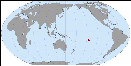
Marutea Atoll Nord FP
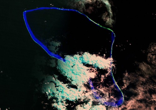
Marutea Atoll Nord FP - Landsat ETM S-07-15_2000 Image (1:150,000)
A portion of the Landsat ETM+ image looks great, the other portion is cloud covered. If I had only used the Landsat image to create my EVS precision map, it would have been an incomplete effort. Fortunately, ISS imagery helped to fill in the gap.
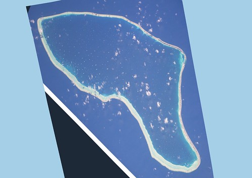
Marutea Atoll Nord FP - ISS006E37438 Image Modified (1:150,000)
First I had to rotate the ISS image and georectify it to my Landsat base image. I was able to do it after much tweaking of the ISS image it was positioned properly for my mapping purposes. Many of the coral heads, which I classify as shallow reef, were derived from the ISS image.
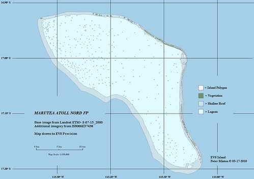
Marutea Atoll Nord FP - EVs Precision Map (1-150,000)
And here is the finished map! If one requires hi-res imagery, it can be found in Google Earth. Located at the channel leading into the lagoon are a few houses. I suspect they are used by coconut or black pearl harvesters. Although the island is uninhabited, people frequent the atoll doing the things that people do, harvesting resources.
Looking at the DigitalGlobe imagery found in Google Earth, large stretches of the island appear to be without a sand covering. It looks as if the island was washed over by a typhoon or a storm surge. Perhaps someone with first hand knowledge might share more about this uninhabited atoll...kind of.
Enjoy!