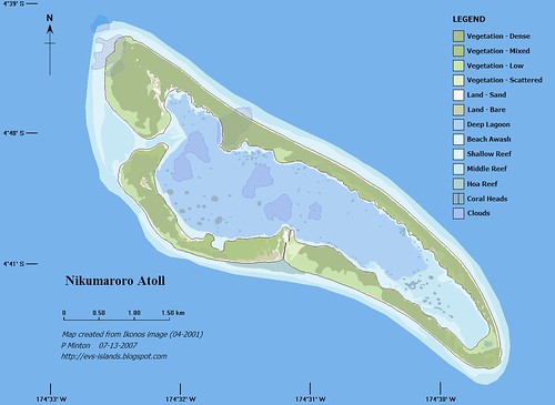
Nikumaroro Atoll KR - EEVS Precision Map (1:30:000)
Why do people visit this site? What is the attraction? Obviously, they come to look at maps. Not just any maps, but maps of islands. Why? Now that is the question.
I remember one of my joys in life was to spend Sundays browsing in the Scripps Institute of Oceanography map collection, which includes an extensive collection of nautical charts. I would spend hours pouring over those charts, dreaming of trips to those far-off islands. Trips that would most likely never happen, but it made difficult times in my life bearable. My chief regret was that I could not spend longer with the charts.
Now, back to my lead question - Why do people visit this site? I think they come to look at my maps of these far-away places to dream about their trips to them. Why else would someone from a bank in Japan look at maps of Greek islands or an employee of Boeing Aircraft check out the map of Nikumaroro Atoll? I believe that the overwhelming majority of people visiting my site are dreaming of islands to visit. They do recognize that my maps typically look pretty good. They are able to compare them to satellite imagery. Most could care less that the underlying metadata is not included, although I have it available. They just want a downloadable map that they can put into a folder named "Islands of the World" located on their computer desktop. When life begins pressing too much, they can check out that distant island and imagine how less complicated their lives might be if only they could spend time on their special place.
Enjoy!
No comments:
Post a Comment