View Motu Iti FP in a larger map
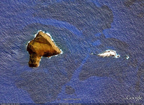
Motu Iti FP - DigitalGlobe Image from Google Earth (1:10,000)
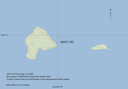
Motu Iti FP - EEVS Precision Map (1:10,000)
According to widely accepted geographical feature identification practices Motu Iti and the rocky islets to the east are classified as islets (> 1 sq km). They are still defined as islands for the purposes of claiming Exclusive Economic Zones (EEZs), sea level to seafloor ownership encompassing a radius of 200 nm or 370 km from this island's shoreline. Interesting as this might be, it is not the reason I mapped these islets. Yesterday, I needed a break from the Komodo Islands project and these islets looked like a good option. I like the Marquesas and these are a part of the Marquesas.
There was nothing especially challenging in the shoreline mapping of these islets. The DigitalGlobe imagery is exceptional. I did preliminary shoreline mapping in Google Earth and finished the project up using Global Mapper. I've spent about 4-hours from start to finish which is par for the course when mapping a simple island shoreline.
Now for my guess work. The main islet, Motu Iti, has scatter vegetation on it. My source, Vegetation of the Tropical Pacific Islands found in Google Books, states that three types of low lying vegetation are found on the islet (Perlman, unpublish notes, 1989). The main islet is said to be 220 meters high. Based on this unsubstantiated elevation, I guesstimated 25-meter contour intervals using visual interpretation of the base imagery. I was unable to use SRTM coverage for these islets as it is of very poor quality. It would be nice to have side views of these islets, but alas, no side views were turned up in my research. Consequently, the elevations are educated WAGs (Wild A...d Guesses).
I'll rest up today and spend time with my wife, doing long overdue honeydos. She will be happy and so will I.
Enjoy!
No comments:
Post a Comment