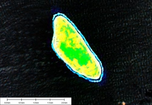
Tepoto Nord FP - Landsat Image from S-07-10_2000 (1:20,000)
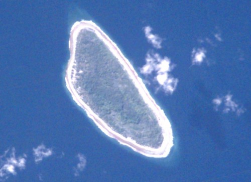
Tepoto Nord FP - ISS002-E-8862 Image
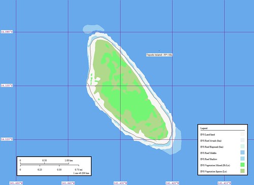
Tepoto Nord FP - EVS Precision Map (1:20,000)
My first map of Tepoto Nord was completed on March 31, 2006. I used Landsat as my base imagery. Most of my finish work was done using Marplot, a fine poor-man's GIS program. In December 2006 , I came upon the ISS image of Tepoto Nord. I decided to redo my original work using the ISS imagery to digitize from.
I look at my completed Tepoto Nord mapping project today and contemplate how far my map making skills have progressed. My digitizing of shorelines, vegetation and reefs remains fairly consistent. I routinely work at between 1:12,000 to 1:8,000, depending on my base imagery and the ultimate objective for my map. I am content to map four to five layers of information taking what Landsat is able to provide. The first time I mapped this island, I remember being frustrated by the Landsat imagery. The odd colors and blurred appearance of the island made digitizing problematic. Eventually, I came upon the ISS image and was able to redo my mapping of this small island in a more satisfactory manner. I reposted the map and base imagery in December 2006 and gave this small island no more thought.
That is until I received a question from an EVS Islands reader. He wanted to know everything he could about this small island. I answered that he should contact Alex W du Prel, publisher of Tahiti-Pacifique magazine. If anyone could give information about this small island, Alex is the man. After answering the reader's question, I checked out my map of the island. Unsatisfactory! The map presentation choices I make today are far superior to those I made in 2006. I decided to redo my redo of this small coral island.
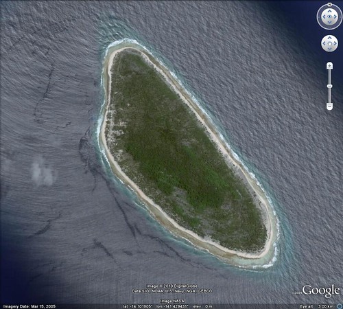
Tepoto Nord FP - DigitalGlobe Image from Google Earth (1:12,000)
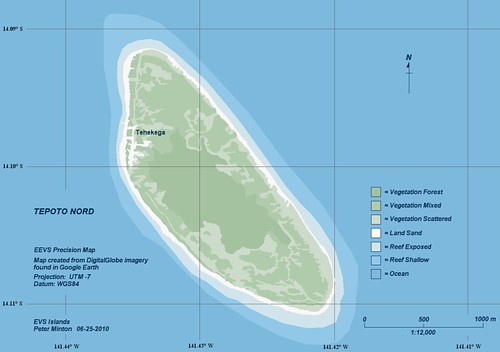
Tepoto Nord FP - EEVS Precision Map (1:12,000)
I checked out Google Earth, as almost all of the islands within the Tuamotus are covered by DigitalGlobe's hires imagery. Sure enough, Tepoto Nord has excellent, cloud-free imagery from which I could redigitize various layers of information with a high degree of confidence. Seven layers of information later my redo of the redo is done. Since I have no designs to offer the map for commercial purposes, I decided to use DigitalGlobe imagery as my base imagery. I have worked on this redo of a redo for about two weeks. Not because it was particularly difficult, but I've been busy with school. Finally, I have a Saturday with no pressing projects. Only this, to finish my Tepoto Nord FP map. Pretty nice, huh?
Enjoy!
No comments:
Post a Comment