View Larger Map
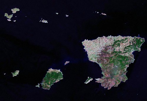
Nisos Aegina - Landsat Island Image Mosaic N-34-35_2000 (1-125,000)
I am currently reworking my map of Nisos Aegina. It is a bedroom island outside of Athens, Greece. A nice little getaway when life becomes too hectic in the big city. But this isn't the reason for this post.
You know that I construct island maps using Landsat ETM+ mosaics as my base imagery. I have a Landsat ETM+ digital library of all of the world's shorelines. I use Global Mapper software to digitize, creating vectors from which i construct my island maps. This software handles the Landsat ETM+ mosaics with ease. I have invested over $500 in Global Mapper and do not regret a cent of it. The software does exactly what I want it to do and Mike, the boss and software guru, keeps making improvements. But this isn't the reason for this post either.
This post poses the age-old question "Is Bigger Better?" as it applies to the world of imagery.
In the world of Landsat derived island specific orthorectified imagery, bigger is not necessarily better. This is the world of imagery anywhere from multi-GB files to a few hundred MB files. These very large image files test the limits of most software packages. Often their formats, (i.e., MrSID) require special handling to open and work with. Since I primarily work with island imagery, I figured that if I were to cut out the ocean and save the island and it's surrounding reefs at a scale allowing me to work at increasing zoom ranges, I could create the same high quality maps from much smaller sized imagery.
First I fashioned a series of Greek island mosaics (see above image). These were followed by a series of Tuamotu Atoll images. I call my creations Landsat Island Image Mosaics (LIIM). Here are a couple of examples showing the zoom capabilities using the Nisos Aegina LIIM as base imagery.
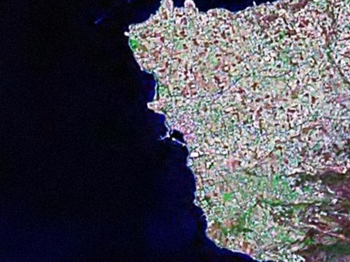
NIsos Aegina - Detail Western Shore LIIM N-34-35_2000 (1-25,000)
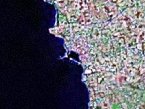
Nisos Aegina - Detail Aegina Harbor LIIM N-34-35_2000 (1-12,500)
I typically digitize shorelines and certain land use features at scales between 1:25,000 to 1:12,500. I know that this pushes far beyond the intended limits of Landsat-7, 14.5 meter resolution imagery. I have digitized at these limits for over four years. The resulting maps have a level of quality and precision that exceeds most widely available island mapping. My island maps have been used by a number of universities to further research and as a platform for spatial analysis by insurance companies.
The size advantage with these considerably smaller island images is significant. My LIIMs range in size from 2 MBs up to 45 MBs for very large islands. All of my LIIMs are saved as georectified JPGs. Nisos Aegina LIIM is 3.47 MBs and is a 15.8 MB Tif file. The Landsat image containing this LIIM, on the other hand, is 106 MBs. The image degradation is slight and barely noticeable. So, I will keep using my LIIM of a specific island from which to create my island maps. If you would like to use one of my LIIMs, drop me a line. I'll fix you up.
Enjoy!
No comments:
Post a Comment