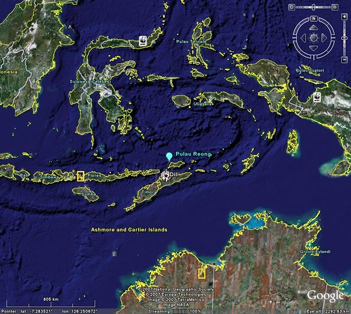
Pulau Reong - Google Earth Locator
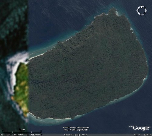
Pulau Reong - DigitalGlobe Image from Google Earth (1:12,500)
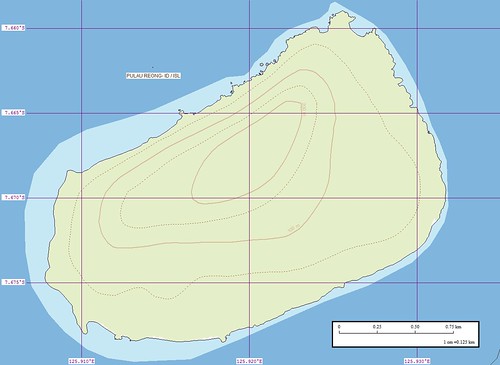
Pulau Reong - EEVS Map (1:12,500)
This island map has taken about 2-hours from start to finish. The most difficult aspect of digitizing it was how to handle the western portion of the island. I elected to use Landsat N-51-05_2000 imagery to complete vectors for the western portion of the island. The majority of the work was done in Google Earth using DigitalGlobe (DG) hi-res imagery.
This island interests me for what it doesn't have. As I studied the DG imagery I cannot find any human signs - no village, no house, no plantation, no large areas of bare earth. It seems that this island's primitive vegetation layer, which is heavily forested, is intact.
I would love to explore this island. Could you image moving through the forest and encountering the flora and fauna within this pristine environment. White sand beaches are found along much of the shoreline. Although the island gets heavy rainfall, there are no visible swamps or mosquito-laden wetlands.
Now back to reality, The island is probably full of bugs, small and large critters. It probably has reptiles named Deadly Five-Pacer. You know, five paces and you're a gonner. Any time you see a tropical forest, the area is innundated with rain and subject to blistering high humidity.
How negative! The explorer in me would love to visit this island. The practical city-dweller, he would still like to visit, but with mosquito nets, raincoats and snake bite kits.
Enjoy!
No comments:
Post a Comment