Balesin Island RP

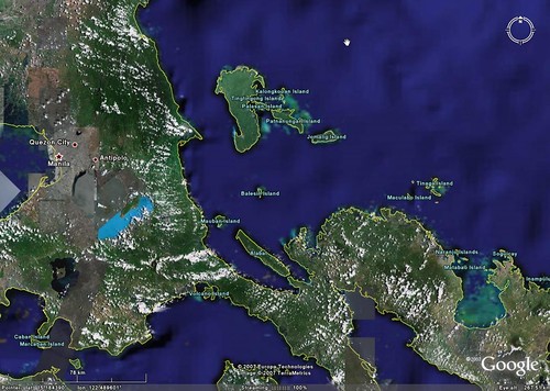
Balesin Island - Landsat Image N-51-10_2000 (1:31,250)
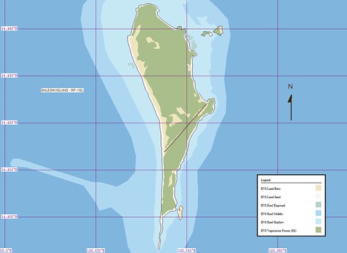
Balesin Island - EVS Marplot Map (1:31,250)
I don't purposely work on islands that have "claim's to fame", but all of the ones I have worked on seem to have interesting stories to tell. Balesin Island is no exception. Seems this small island is the location of a high-class resort. You and 40 of your friends can enjoy the miles of sandy beaches. Just pony up $85 per room per night and transportation to the island. Your accomodations are top rate. The service is exquisite. Everything is first class.
I was going to say something silly, but I won't. I have never been to the island, but one of the websites that sells the islands attributes makes it look great. Now, alittle about why I mapped it.
One of my students wants to become a cartographer. During my lunch time, I showed her how I go about making an island map. Since I had this Landsat image loaded on my computer at school, I slected a small island, Balesin Island. I showed her how to digitize a shoreline and the various layers of additional information that I would map to complete this project. I estimated that this project would require an additional 4-hours of work. It has taken about 6-hours to complete. Tomorrow, I'll share this completed project with my aspiring cartographer. Hopefully, she will remain inspired.
Enjoy!
No comments:
Post a Comment