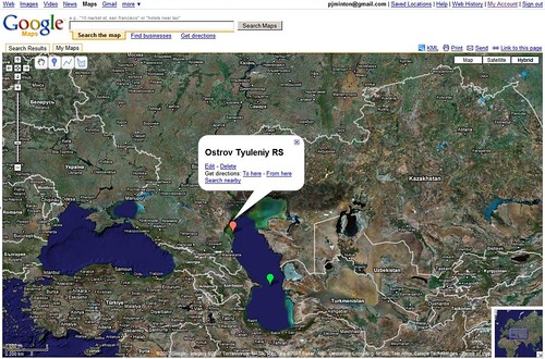
Ostrov Tyuleniy - Google Map Locator
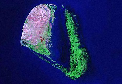
Ostrov Tyuleniy - Landsat Image N-38-40_2000 (1:50,000)
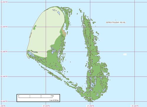
Ostrov Tyuleniy - EVS Map (1:50,000)
This Caspian Sea island is off of the coast of Dagestan. I have been digitizing this island for the past week. It was a fairly complex project due to the marshland that makes up much of the island. My research uncovered reports on Tyuleniy birds, insects, fish and crude oil exploration. The crude oil exploration was conducted back in 2005 by the German company Wintershall. Turns out they are one of the big players in the world of oil. They are working with Russian groups to explore this potentially oil rich region in the Caspian. My look into Wintershall's website did not uncover any additional information.
I like my map. It looks good and is as accurate as Landsat imagery allows.
Enjoy!
No comments:
Post a Comment