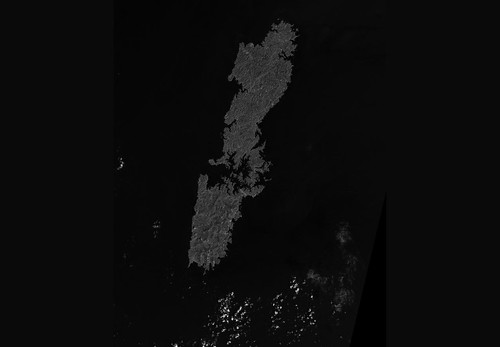
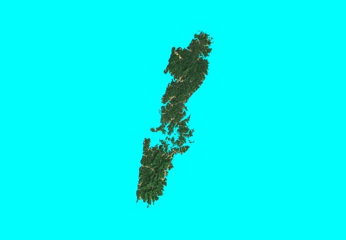
Tsu-Shima - Landsat from USGS WRS - Original Image (1:500,000)
I did my "load and explore" exercise, where I take a random Landsat ETM+ mosaic, load it and see what looks interesting. Fortunately, I traveled to a part of the world I studied while in college, Japan. Although I speak some Mandarin Chinese and very little Japanese, my emphasis within my Asian Studies major was Japan. The islands making up Tsu-Shima rest between Japan and Korea. Both Korea and Japan claim ownership, but it appears Japan has "squatters rights" to the islands. The islands have a long history of human occupation, but the current human footprint is relatively small - over 85% of all of the islands land area is in a natural state.
So, why not transform the black and white Landsat WRS image into a useful colorized image. I decided to give it a try.
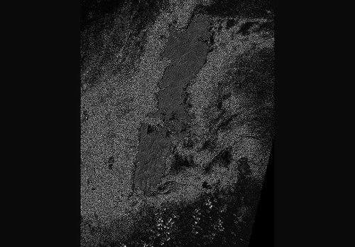
Tsu-Shima - Landsat from USGS WRS - Creating a Single Color Sea Mask - First Pass (1:500,000)
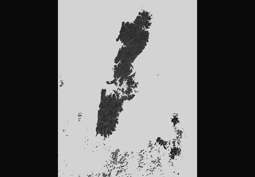
Tsu-Shima - Landsat from USGS WRS - Sea Mask as a Single Color (1:500,000)
My first task was to isolate the land area making up Tsu-Shima islands. I did this using a feature within Global Mapper v9.0 that allows you to isolate certain colors and to make them transparent. One merely identifies a RGB (i.,e., 010,215,215) color and turns it off. The first image in the two above shows a first pass. It took seven passes to convert the sea mask into a single color. Each pass required that I save the modified raster image as a TIFF file. After a number of passes, I ended up with the second image. The cloud-like features in the lower portion of the image are clouds. They were dealt with later.
Tsu-Shima - Landsat N-52-30_2000 (1-500,000)
The Landsat ETM+ image taken from N-52-30, has way too much black and the shoreline is tough to clearly makeout. I am certain others could easily determine shorelines with a smart routine that identifies shoreline colors, but I don't have this level of expertise or the software. So, I forged ahead in my pedestrian manner. Taking the above Landsat ETM+ image, which is georectified, I overlaid my modified Tsu-Shima Landsat WRS image on top of it. Again, using a Global Mapper v9.0 feature, I made the top image (Landsat WRS) 60% transparent, allowing the green vegetation layer to appear to drape onto the top image.
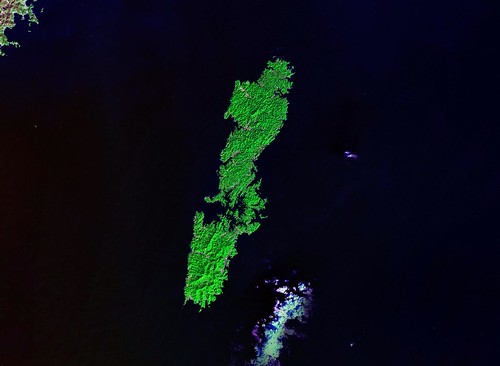
Tsu-Shima - Landsat from USGS WRS - Land Mask Colored (1-500,000)
I saved the resulting image, moved it into ImageForge, my "poor man's Photoshop", and touched it up. I made the sea mask a single blue color and the urban areas were changed to a gold color. I saved the modified image. I loaded this final Tsu-Shima image into Global Mapper, where it was georectified. Tsu-Shima image is good to use between 1:500,000 to 1:62,500. Anything larger and the shorelines are a series of clunky pixel shapes.
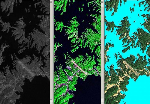
Tsu-Shima - From Landsat WRS to Landsat Modified - Central Detail
From a black and white Landsat WRS to my Landsat modified image took 4-hours to complete. I have a series of georectified TIFF image of the islands. As with all of my previous projects, they are available at no charge. Just drop me a line and let me know what you need. I like the look of my Landsat modified image of Tsu-Shima. Don't you?
Enjoy!
No comments:
Post a Comment