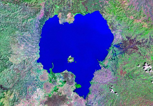
Lake Tana - Landsat N-37-10_2000 (1:500,000)
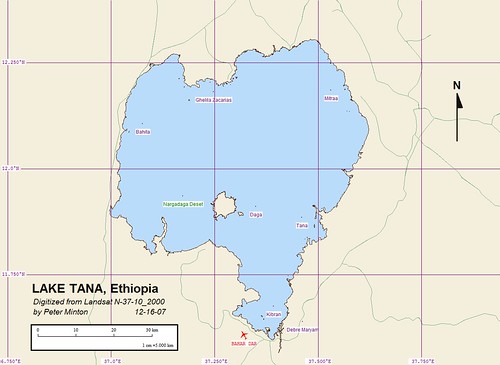
Lake Tana - EVS Precision Marplot Map (1:500,000)
At times I like to open a Landsat ETM+ of a region of the world and explore. This time I traveled to Africa, specifically to Ethiopia. I know the country of Ethiopia is perched on highlands and Lake Tana is the primary source of the Blue Nile. I also have read the story of the Ark of the Covenant being spirited away from Israel first to upper Egypt at Elephantine Island, then to Tana Island and finally to St Mary of Zion Church in Axum. My curiosity about Tana Island got the best of me. My first task was to research to see if any maps of the island were available via the Internet. Nothing! Not even of the lake!
So my first task was to rectify the mapping of Lake Tana. The only mapping I have depicting this lake are at a scale of 1:1,000,000 (DCW). The shorelines are very coarse approximations of the Landsat imaged shorelines as depicted on N-37-10_2000. I have spent the last 6-hours mapping the shoreline of this lake. I worked at a scale of 1:31,250 for all mapped shorelines. Smaller islands in the lake were mapped at an even larger scale. The lake's shorelines were easy to discern and digitizing was uneventful, but tedious.
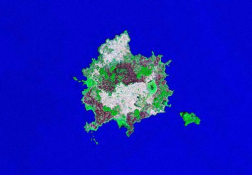
Nargadaga Deset - Landsat N-37-10_2000 (1:62,500)
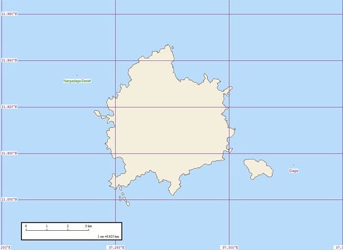
Nargadaga Deset - EVS Precision Marplot Map (1-62,500)
This is the largest island within the lake and the largest island in Ethiopia. I carefully digitized it's shorelines, figuring the largest island had to be Tana Island. That is until I finished and began working in Marplot. It is there that I have my EVS Island name file (86,000+ named islands). It turns out bigger is just bigger. It is not Tana Island but Nargadaga Deset. Although it is a holy island, it wasn't the holy island I wanted.
After a little searching I found Tana Island located along the eastern shore of the lake. Not a large island, but at one time, the reputed resting place of the Ark of the Covenant.
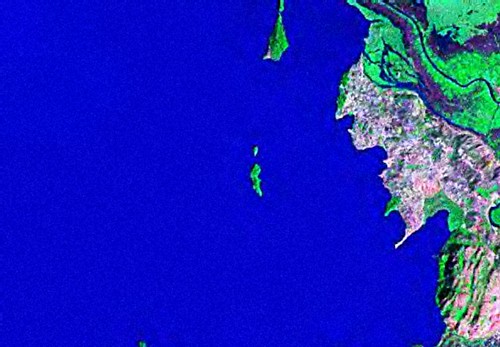
Tana Island - Landsat N-37-10_2000 (1:31,250)
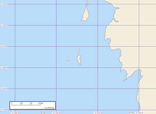
Tana Island - EVS Precision Marplot Map (1:31,250)
Here is Tana Island, all of 500-meters by 50-meters. It is a holy island, with a monastery located on it. No woment are allowed to visit the island. The priest living on the island will show any men visitors where the Ark was kept while on the island.
This was a fun mapping project. I got to map a number of islands at EVS precision. I went back to my mapping roots using Landsat ETM+ as my base imagery and didn't have to worry about offending any image owners and I mapped a major lake to boot! Now, that's living the high life.
Enjoy!
No comments:
Post a Comment