I have over 600+ Landsat ETM+ Orthorectified Mosaics that two summers ago I patiently downloaded and copied onto a series of DVDs. These mosaics cover all of the shorelines and oceanic islands throughout the world. It is an impressive collection. This collection, coupled with Global Mapper v9.01 (GM), allows me to load and view the individual mosaics as I desire. Each mosaic, even compressed in MrSID format, is typically 100 to 250MBs. Them is some big files!
Over a year ago I had a discussion with a reader who wished to work with these files to make his own maps. I described where he could download the files. But, alas, he said the files, even in MrSID format, were too large for his system. Was there a smaller file of just individual islands, he asked. Not to my knowledge, I guessed and went back to making maps of islands.
That was until this past month and my work in image mosaics. First I worked with DigitalGlobe imagery. Sadly, they have never responded to my product idea. Oh, well, so goes life. Lately, I've been working with Landsat ETM+ again. And the following is my latest idea - Landsat Island Image Mosaic or LIIM.
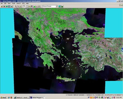
Greek and Turkish Islands - Landsat ETM+ Mosaics
Some of my earliest mapping efforts were of Greek and Turkish islands located in the Aegean Sea. This area is virtually cloud-free and the clarity is outstanding. However, it takes seven Landsat mosaics to cover the area. Using a raster export feature within GM, I experimented with various raster formats and came up with georeferenced JPG. Pixel size of each resulting LIIM is 14.5-meters, 300 DPIs and projection is Mercator. The resulting image is outstanding.
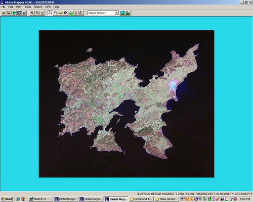
Nisos Limnos - Landsat ETM+ N-35-35_2000
I zoomed into my target area encompassing the primary island and created the georectified JPG. The above Nisos Limnos LIIM taken from GM gives the user the complete resolution power of Landsat ETM+ without the size problems. The above file, along with it's accompanying DEM, is only 7.2MBs.
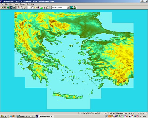
Greek and Turkish Islands - SRTM Tiles
To really bring the Nisos Limnos LIIM to life, the SRTM data is the ticket. To cover the Aegean Sea one needs 83 individual SRTM tiles. Loads of data for most of us. Many of these tiles require some fixing, which is done using SRTM Fill (freeware) to fill holes. Once this data is loaded, GM allows for DEM creation. One is able to take the Nisos Limnos DEM and drape the Nisos Limnos LIIM on top and get a variety of 3D views of the island.
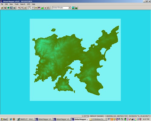
Nisos Limnos - SRTM N039E025
So I exported the underlying area into DEM format. This allows for some nifty looks at the island
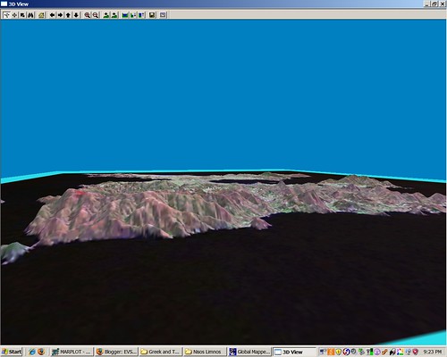
Nisos Limnos - 3D View
Pretty cool! This is the Nisos Limnos LIIM draped over the Nisos Limnos DEM. All of this wrapped up in a 7.2MB package. I like it. How about you?
I should add that I have created 16 Greek and Turkish Island LIIMs. The following islands have LIIMs - Bozcaada, Gokceada, Nisida Fournoi, Nisida Gioura, Nisos Agios Efstratios, Nisos Alonnisos, Nisos Chios, Nisos Ikaria, Nisos Lesbos, Nisos Limnos, Nisos Pelagos, Nisos Samothraki, Nisos Skiathos, Nisos Skopetos, Nisos Skyros and Nisos Thasos. I intend to complete coverage of the islands of the Aegean before I head back to school on Jan 03, 2008.
Enjoy!
No comments:
Post a Comment