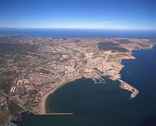
I enjoy enclaves. The Portugese scattered these trading ports along the costs of Africa and India. The Spanish were more into settling, however in the case of Morocco, they established enclaves - Ceuta and Melilla. Above is an aerial photo of the limits of Melilla looking from the port toward the northwest.
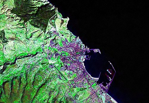
Melilla Enclave Border Fence Limits Study - Landsat ETM+ N-30-35_2000 (1:40,000)
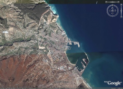
Melilla Enclave Border Fence Limits Study - DigitalGlobe Image from Google Earth (1:40,000)
Using the above two base image sources, I created a shoreline map of Melilla. Working first off of Landsat, I created a rough EVS precision shoreline map. Working with DigitalGlobe imagery from Google Earth, I decided to not only track the shoreline using 1-meter resolution imagery, but also to determine the course of Melilla's border fence.
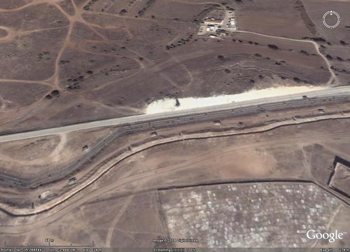
Melilla Enclave Border Fence Limits Study - DigitalGlobe Image from Google Earth - The Border Fence

Melilla Enclave Border Fence Limits Study - BBC Image_40847408_twosides220afp
Back in 1977, I travelled to Berlin on business. While there, I visited Checkpoint Charlie and viewed the Berlin Wall. I hated that wall! It stopped what should have been normal flow of peoples and goods within Berlin. I get the same feelings when I look at the Melilla Border Fence. It was built to keep Africans out. Not only out of Melilla, but ultimately out of Europe. It seems the "Haves" cannot accomodate the "Have Nots". The world just has too many hungry people for all of us to care for. I'm sorry. I'll get off of my soapbox and get back to my map.
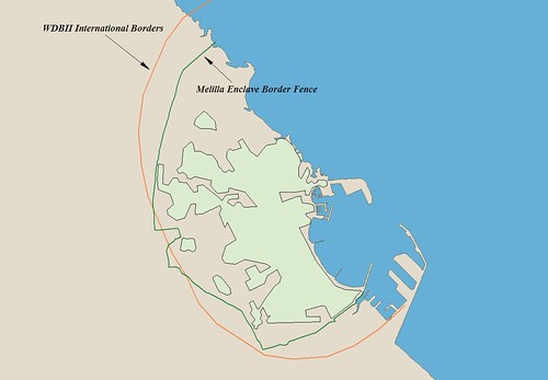
Melilla Enclave Border Fence Limits Study - EEVS Precision Map (1:40,000)
My international borders come from the NGDC Coastline Extractor. Specifically from the dataset called WDBII International Borders. These borders are used in many global mapping packages. They work, kind of. In my above map I traced the Melilla Enclave Border Fence from start to finish. I'm not sure if that represents the actual border between Melilla and Morocco, but it seems pretty final to me. My Melilla map shows the WDBII borders (orange line) and the fence line (green line).
So, if you want to create the definitive Melilla - Morocco border, I'd say the fence line seems to be a natural dividing line. I wait for the day border fences that separate people unnecessarily can be removed and allow us to move freely as we wish and as we should.
Enjoy!
No comments:
Post a Comment