View Larger Map
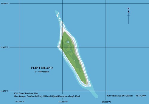
Flint Island - EVS Precision Map (1":650-meters)
I have taken my original EVS Precision map and made it better. Using the DigitalGlobe image from Google Earth, I was able to add 4 small ponds. They are full of brackish water. It is said one could drink the water, but it is on the salty side.
During a circa 1974 expedition a fire was started. It burned a native stand of Pisonia Grande trees and smoldered for a few years. It is finally out, but the fire did lasting damage. However, deep damage was done to this small island during the late 19th century - that's when guano was mined. The mining leaves scares that deep into the island's surface.
I believe the above map is a significant improvement my original mapping efforts.
Enjoy!
P.S. - Thanks to Frank at Google Earth Blog for the reminder - "Please include an embed GE Map to help readers locate your mapped islands". Frank's a good man and offers helpful advice in a kind and gracious manner.
No comments:
Post a Comment