View EVS Islands Projects in a larger map
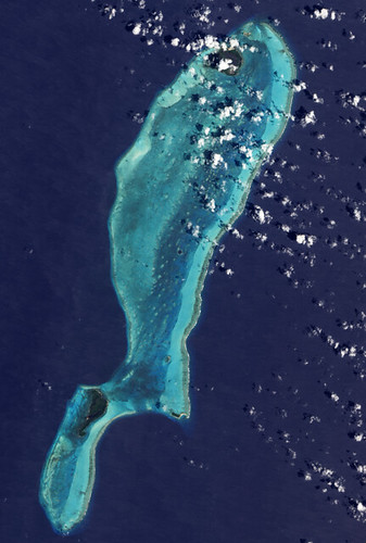
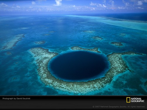
Lighthouse Reef and The Great Blue Hole from Advanced Land Imager (ALI) on NASA’s Earth Observing-1 Satellite
On April 3rd the above image was posted to Earth Observatory's Image of the Day. I read the article with mild interest. I was aware of the these features, cenotes, being found throughout this part of the world. After downloading the 4 MB image of the entire reef, I figured that it would be an excellent island mapping project. I checked out the Landsat ETM+ image and it is cloud free and quite detailed. So, I began to map it.
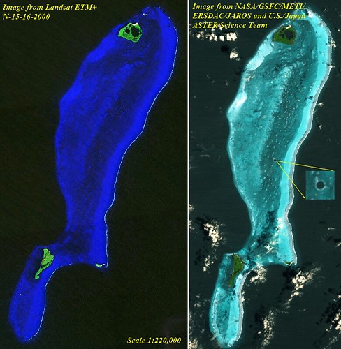
Lighthouse Reef and the Great Blue Hole - Comparison Landsat to ASTER Images
The small cays that are located on the reef at first glance looked to be fairly simple. They were not! Wanting to do justice to the details shown on the base image, my digitizing was ultimately complex. I worked at scales between 1:25,000 to 1:12,500 for most of my digitizing.
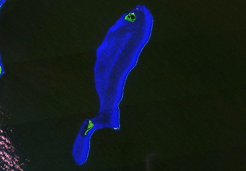
Lighthouse Reef and The Great Blue Hole, Belize - Landsat ETM+ N-16-15_2000 Image (1-220,000)
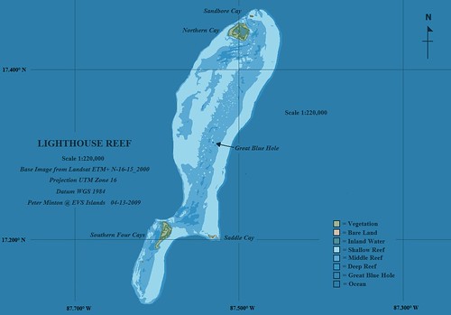
Lighthouse Reef and The Great Blue Hole, Belize - EVS Precision Map Preliminary (1-220,000)
10-days and about 20-hours later, I am done. All of the layer colors used are my usuals, except for the ocean layer. I went with a darker blue. In my opinion, the deep blue ocean color accents the many shades of blue used in detailing the reef system.
If you are curious about this feature follow the links found throughout this post. Wikipedia also has an informative article about the Great Blue Hole you might find interesting.
From a mapping perspective, I am pleased with my finished product. However, to truely appreciate the amount of detail included on the map one needs to study the vector map. It is really cool! Oh, well...I'm glad it's done. Now on to the north coast of New Britian and more reefs.
Enjoy!
No comments:
Post a Comment