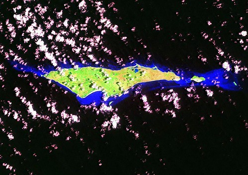
 Samana Cay - Landsat ETM+ Image N-18-20_2000(1:85,000)
 Samana Cay - EVS Precision Map (1-85,000)
My interest in Samana Cay was the result of a serendipitous moment. A few evenings ago while editing my Islands of the World point file, I became curious about the Turks and Caicos Islands. Using my GSHHS World Shoreline map, I located the Turks and Caicos Islands. Not an area I have done much mapping in, but interesting. To the northwest was a small island off by itself,
Samana Cay. Nothing particularly outstanding, just a nice little island facing the Atlantic Ocean. Curious soul that I am, I checked out the Wikipedia article and Wow! Some scholars think this might be the site of Christopher Columbus' first landfall in the New World. Pretty cool.
I identified the Landsat ETM+ mosaic, loaded it into Global Mapper and began mapping. The completed map is nice. The Landsat image is pretty cloudy. More research and my next Wow! Samana Cay is the largest uninhabited island in the Bahamas. An uninhabited island close to home (USA). How cool.
All of you Florida readers hunting for your Crusoe Getaway, Samana Cay could be your island. People from Acklins Island visit periodically to collect cascarilla bark. Other than the occasional Acklins Island visitors, you could be all alone contemplating whatever it is you want to contemplate.
Enjoy!
No comments:
Post a Comment