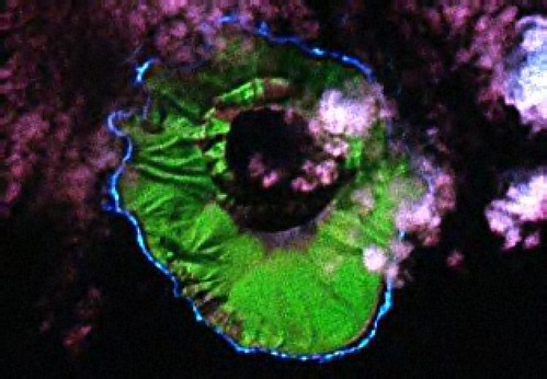
Kasatochi Island - Landsat Image from N-01-50_2000 (1:16,820)
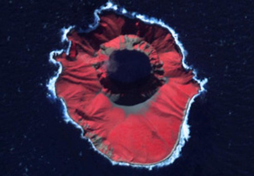
Kasatochi Island - ASTER-Terra Image AST_2003273 (1:16,820)
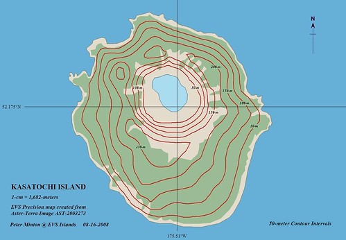 >
>Kasatochi Island - EVS Precision Map (1:16,820)
I am an opportunistic island mapper. When I encounter an interesting island and it is mappable, I map it. So it goes with Kasatochi Island. Today's article in Earth Observatory Newsroom detailed the recent activities of Kasatochi Island. Located toward the western end of the Aleutians, this typically dormant volcanic island erupted on August 7, 2008. The eruption spewed out such a large amount of ash that Alaska Airlines cancelled 44 flights. The volcanic activity has continued and is being monitored daily by the Alaska Volcano Observatory (AVO). Follow the aforementioned link and it will give you all of the latest facts concerning this island's volcanic activity.
The Aster-Terra image is dated 09/23/2003, well before the current eruption. The Landsat image predates this by at least two years. I have no post eruption images, so all you get is a before map. The island is covered by vegetation, most probably low lying grasses. I am certain this eruption has refashioned the island's ground cover. At the bottom of the caldera was a small lake. It was probably vaporized in the eruption. When post eruption images become available, I will make a post eruption map to go with the above map.
Enjoy!
No comments:
Post a Comment