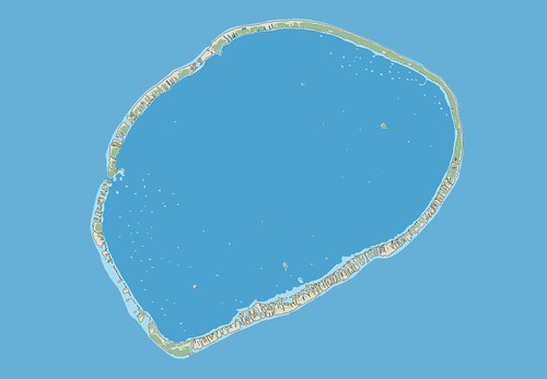
Tikehau Atoll - EVS Precision Map (1:150,000)
San Diego is hot and humid. A Mexican tropical storm is swirling up our way. We don't get rain, we only get hot and humid weather. So what did I do on this uncomfortable evening. I watched Sylvester Stallone in Rambo, First Blood and finished an island map. I had completed 1/3 of the atoll previously. This evening I completed the remainder of the map. At least the map, less the legend and all of those other necessary things that make a map a map. I will add the other necessaries later.
I was going to include some nifty Flickr photos of Tikehau Atoll. There are many gorgeous photos, but their distribution is restricted. If you want to see them, follow the above link. The photos are of the Tikehau Pearl Beach Hotel, classified as a 4-star hotel.
The resort is nice, but my map is better.
Enjoy!
Tikehau Atoll FP - The Morning After
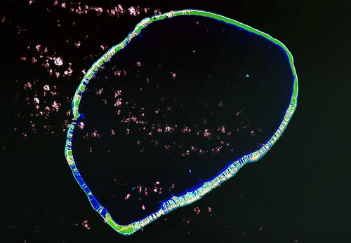
Tikehau Atoll - Landsat ETM+ S-06-10_2000 and S-06-15_2000 (1:150,000)

Tikehau Atoll - EVS Precision Map (1:150,000)
After resting for five hours, I had my morning cup of coffee, while working on my final Tikehau Atoll map. And here it is. I am working to make my presentation consistent. Consequently, my "fancy" work is done in ImageForge, MS Paint, Irfanview and Global Mapper. I use Times New Roman fonts with the island name in 16-pt bold, the credits and scale in 12-pt italic bold and the lat-lon labels in 10-pt bold. I use MS Paint for the lat-lon lines because it lets me draw a straight line. Finally, if I need to crop, resize or reformat a map, I use Irfanview.
Enjoy!
No comments:
Post a Comment