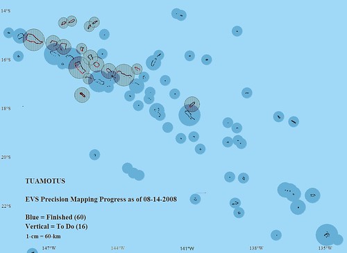
Tuamotu EVS Precision Mapping Progress
It has been nine days since my last post. What have I been doing? Keeping up with my summer duties - "honey do's", watching and entertaining my grandchildren (9 and 6 years) and mapping the Tuamotus. My goal this summer was to complete all 4 layers of EVS precision mapping for each of the 76 islands within the group - island polygon, vegetation, shallow reef and deep lagoon. To date 59 islands are complete. What exactly does that mean?
76 islands is not quite accurate. The Tuamotus are made up primarily of atolls. Each atoll has a number of islands, motus, to be exact. Just how many? A preliminary count puts the number of motus at approximately 5,640. Those are above water land. If the motu contains vegetation, I create a vegetation polygon. That means another 1,100 polygons to create (about 20% of the motus contain significant vegetation). Each atoll is surround by a shallow reef and an interior deep lagoon. However many of these interior lagoons are peppered with coral heads. If they show up on my base imagery, I map them. Probably another 2,000 polygons. All in all, I have to digitize 8,740 polygons, at least, to complete my summer project.
I have finished 59 atolls leaving me only 17 atolls to map. That is the good news. Now for the challenging news. Those 17 atolls will contain about 60% of the remaining polygons. All I have left to do is digitize another 5,240 polygons and I'll be finished.
If that seems like alot, it is. However, when this island group is mapped to EVS precision I will have accomplished my summer goal. It might be December 2008 before I complete my summer goal, but complete it I will. Wish me luck and...
Enjoy!
No comments:
Post a Comment