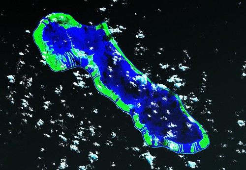
Anaa Atoll FP - Landsat ETM+ Image S-06-15_2000 (1:125,000)
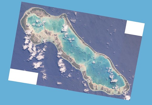
Anaa Atoll FP - ISS006-E-34723 and 34724 Image (1:125,000)
Prior to beginning an EVS precision island mapping project, I scout for ISS imagery, especially ISS-006 imagery. Some excellent cloud-free images were captured during this mission. In the case of Anaa Atoll, Landsat ETM+ had some cloud issues. I downloaded, combined and georectified ISS imagery. Working with the Landsat image beneath the ISS image gave me excellent detail from which to create my finished EVS precision map.
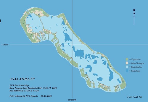
Anaa Atoll FP - EVS Precision Map (1:125,000)
For me, the most interesting feature on this map is the shallow lagoon. It has a few deep areas, but is overall shallow with most underwater features within it close to the surface. The atoll has a permanent population of 435 people (2002 census) scattered between a main village and a couple of smaller settlements. According to the Wikipedia article about Anaa Atoll, the soldiers that lived on Anaa were an especially viscious group. In 1769, James Cook was the first European to sight the atoll.
This mapping project took about three weeks to complete using an on-again, off-again pace. Seems my life has gotten complicated between preparing for the new school year, watching my grandchildren, completing "honey-do's" and squeezing in map work late at night.
Enjoy!
No comments:
Post a Comment