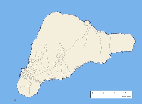
Easter Island - EEVS Map Roads (1:100,000)
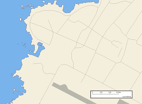
Easter Island - EEVS Map Detail Hanga Roa Village Roads (1:6,250)
It is 8:30 AM and I have finished the Easter Island road layer. The village, Hanga Roa, has the majority of the roads found on the island. The image resolution I am using does not show hi-res details outside of Hanga Roa. I will compare my digitized road network with the road network found on the DigitalGlobe image in Google Earth.
Let's call this road layer my preliminary effort. I have some verification work remaining and road segment determination to complete before I finalize this layer.
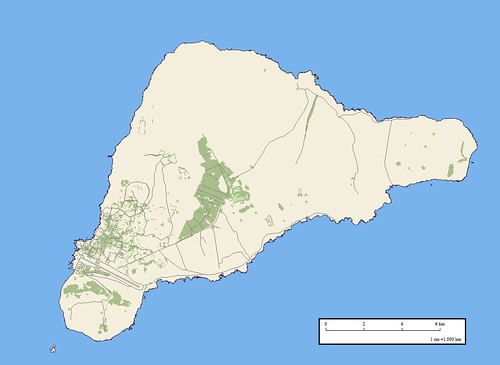
Easter Island - EEVS Map Vegetation and Roads (1:100,000)
This is the extent of my Easter Island mapping project; shoreline with off-lying rocks, vegetation (trees) and roads. I have invested about 14-hours of labor to create the current view of Easter Island. My next layer will be another vegetation layer. It will include all other low-lying vegetation.
Enjoy!
No comments:
Post a Comment