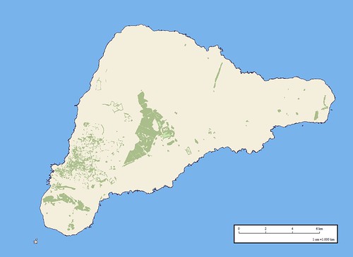
Easter Island - EEVS Map Vegetation (1:100,000)
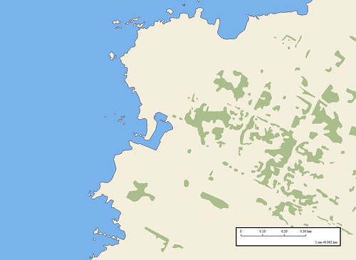
Easter Island - EEVS Map; Detail Hanga Roa Village with Vegetation (1-6250)
I am continuing work on Easter Island. Just having finished a vegetation layer that shows distribution of trees, I decided it was time to post a progress report with a couple of observations.
First, about the trees. In the movies Rapa Nui the inhabitants destroyed the forest to transport their mega-moais. What I have learned from this current mapping exercise is that trees are growing on Easter Island. There are a number of large tracts of trees and many individual trees are scattered about the village of Hanga Roa.
Second, What about the detail? The second map is a zoom of the southern portion of the village of Hanga Roa. The scale is 1:6,250. This is possible because I am using a DigitalGlobe image found in Google Earth as my base image. I was able to map shoreline details (offshore rocks above water and awash) that have, most likely, never been mapped before, primarily, because of the availability of hi-res imagery. The final map will distinguish between rocks awash and rocks above water. For now they are part of the Land-Island layer.
My next layer will be the roads, paths and airfield. I'll post it when I've finished the next layer. So far, this is one of my most complex mapping projects consisting of lots and lots of vectors to show two layers of information.
Enjoy!
No comments:
Post a Comment