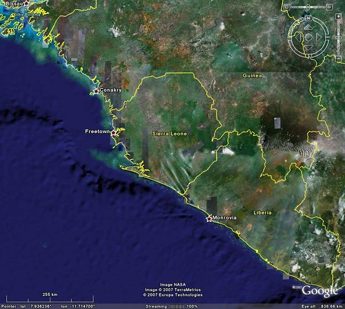
Sierra Leone and Sherbro Island
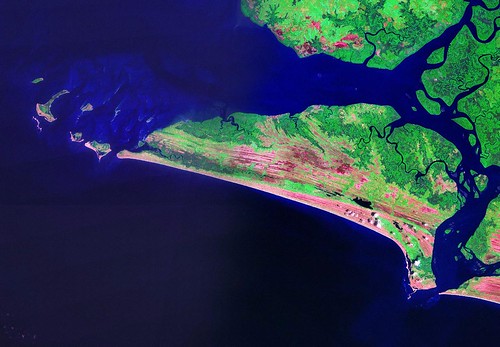
Sherbro Island - Landsat N-28-05_2000 (1:275,000)
Sherbro Island is located in the center of the first image. As can be seen in the next image, it is a fairly large river-mouth island, which typically results in large portions of the island being water-saturated with highly dynamic shorelines. That is the case for much of this island. However there are other parts of the island that are of a more permanent nature. For example, the southwestern ocean-edge of the island is uplifted and less subject to the whims of the weather and river dynamics.
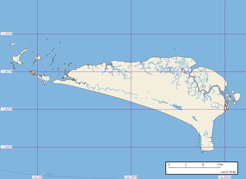
Sherbro Island - EVS Marplot Map (1:275,000)
This project has resulted in long hours of water-feature digitizing. Because the vectors were created using Landsat imagery, the digitizing task was simplified. However it has been a chore getting the project to this point. I still have a number of landforms to digitize (swamps, mudflats, sandbars, etc.).
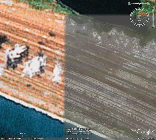
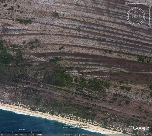
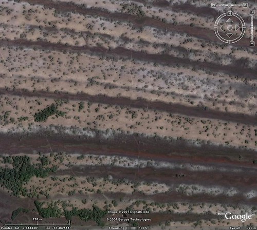
Sherbro Island - What is this landform?
I think this landform is a series of old shorelines. The zoomed images show trails crisscrossing them leading to a from the ocean shore. When I first saw this feature, I thought it might be areas of cultivation. After studying the DigitalGlobe image from Google Earth of this landform, it doesn't appear to be cultivated areas.
My question to EVS Islands readers, "What is this landform?". Thanks in advance.
Enjoy!
No comments:
Post a Comment