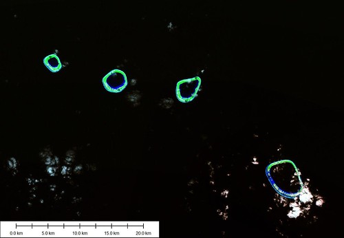
Groupe Acteon - Landsat Image S-08-20_2000 (1:200,000)
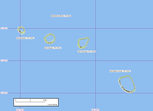
Groupe Acteon - EVS Map (1:200,000)
Ignorance is bliss. or so they say.
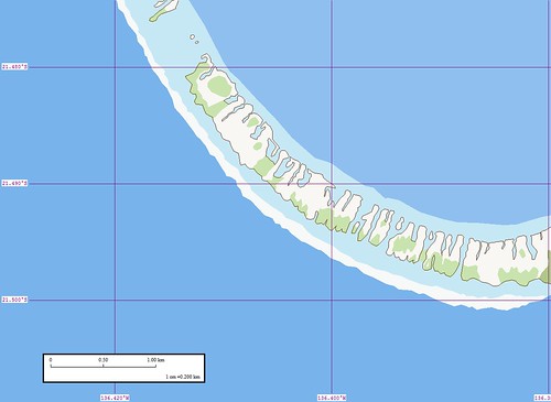
Two years ago I was thrilled to make a map using Landsat ETM+ as my base imagery. These Enhanced Vector Shoreline (EVS) maps are some of the most detailed, consistently formatted and visually appealing maps freely available to any and all. I have mapped islands, employing rigorous and proven procedures, ensuring that the stage, which consists of Landsat images and EVS maps, is clearly rendered so that their individual stories can be told in their unique geographical context, as evidenced by the Groupe Acteon Landsat image and EVS map above.
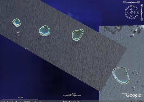
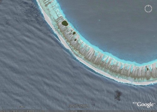
Groupe Acteon - DigitalGlobe Image in Google Earth (1:200,000)
Ignornace is bliss. until you know what you know.
What used to be, in Google Earth (GE), a smudge of green suggesting land, is now DigitalGlobe's (DG) high resolution imagery. GE and DG, working together, gives us exquisite high resolution views of islands throughout the world, including Groupe Acteon. Where Landsat ETM+ used to rule, not so anymore. The new ruler is DG using GE's mapping platform. DG's high resolution imagery costs big bucks, unless you are a mega-funded government agency. Big bucks that us little folks will never be able to afford. Working with GE, this imagery is now ours to view. Oh, yes, and ours to use as base imagery to create non-commerical maps (just make sure you credit sources).
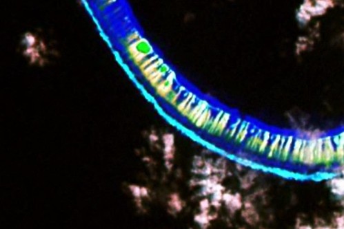
Last night, I finally faced up to a harsh reality - EVS quality pales in comparison to Extremely Enhanced Vector Shorelines (EEVS) quality which comes from DG's high resolution imagery. The improvement in shoreline resolution is dramatic. What Landsat suggests, DG clearly shows. Striving to produce the best map, I am faced with a genuine dilemma, to redo EVS quality maps when EEVS quality is available, or not. I want to say "Not.", but I realize "Redo" is, most often, the correct response. Let me explain. The islands I map are very small chunks of real estate. Consequently, little digitizing inaccuracies become very big mapping inaccuracies. Take a look at the following.
Matureivavo Atoll - Landsat Image S-08-20_2000 (1:20,000)
Matureivavo Atoll - EVS Map (1:20,000)
Digitizing from the Landsat image, I was able to create the above EVS map of Matureivavo Atoll. Considering what Landsat was able to show, in my opinion, the resulting map was a solid effort. However, Landsat, at 14.5 meters per pixel is not DG HiRes at 1 meter per pixel.
Matureivavo Atoll - DigitalGlobe Image from Google Earth (1:20,000)
The EEVS map I will create, using the above DG imagery, will be considerably different than my Landsat effort, as it should be. I will map the majority of this complex reef as being water inundated. The small sand bars will be mapped as above water features. The sparse vegetation layer along this reef will be designated as underwater vegetation and be mapped accordingly. The resulting shoreline of this section of reef will be considerably different. Much of the original EVS quality shoreline will now be mapped as an underwater feature. I will make many different mapping decisions based on this high quality image, resulting in an EEVS quality map.
The horns of my dilemma - Is there room for both EVS and EEVS quality mapping?
Obviously, when Landsat imagery is the only available imagery, EVS rules. However, when DG imagery is available for the same area, EEVS rules. As I compare my EVS maps to DG's EEVS quality imagery and I find the EVS details are of sufficient quality to qualify as an accurate map, it will remain. If I compare an EVS map to DG's EEVS quality imagery and find it lacking in detail and accuracy, I will redo it.
Enjoy!
No comments:
Post a Comment