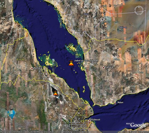
Jabal al-Tayr Island Location from Google Earth
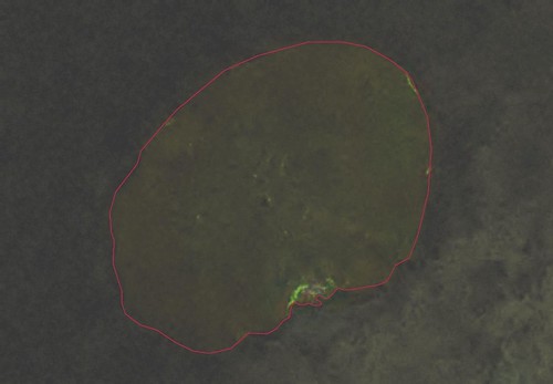
Jabal al-Tayr - Landsat Image N-37-15_2000 (1:25,000)
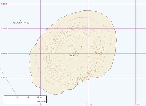
Jabal al-Tayr - EVS Map (1:25,000)
In the southern portion of the Red Sea at 15.54N 41.83E is this small island. If you didn't know where it's located and you are using Landsat to find it, it's very difficult to see. Using some image modifying features found in Global Mapper v9.0 the island shows up. It looks like there are clouds swirling off of the southeastern portion of the island. These clouds appear to be very dark and dusty, like volcanic ash. Well it turns out that this little round island is actually a very active volcano. According to a post in Google Earth Blog this little island's recent eruption led to the death of 8 Yemeni citizens. The post includes a KMZ file that includes the above posted Landsat image.
My EVS precision map of Jabal al-Tayr accents the island's simple shoreline. In addition, it
includes 20-meter elevation contours. I used Global Mapper's contour generation routine. One needs to import the appropriate SRTM, then generate your contours.

Jabal al-Tayr - DigitalGlobe Image (Non-obscured)
DigitalGlobe has a non-obscured image of the island, for a price ($400+) for those of you wanting to do additional research on this island.
The Red Sea is one of the world's critical ship transit channels and smack dab in the middle is this active volcano. If that doesn't beat all!
Enjoy!
No comments:
Post a Comment