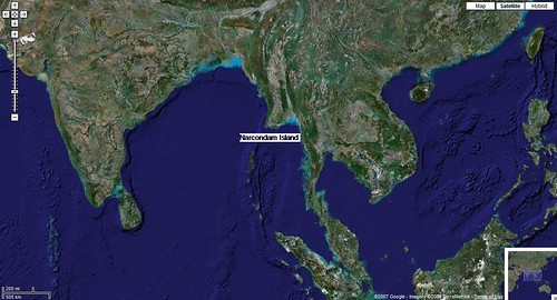
Narcondam Island IN - Google Locator Map
This small island 3km x 4km is a dormant volcano located 130km east of the Andaman Islands.
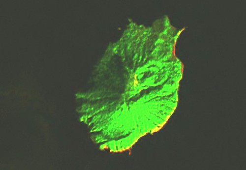
Narcondam Island - Landsat Image N-46-10 (1:25,000)
Initially, the Landsat image was very dark. The western shoreline was very difficult to discern. So the image has been lightened and the various band colors have been adjusted. Finally, the image was changed to a format called "difference" in Global Mapper. By doing this I could make out almost all of the western shoreline
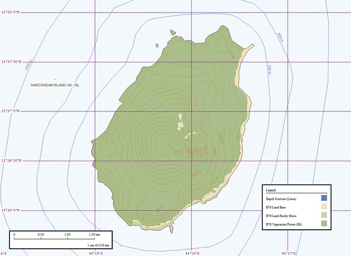
Narcondam Island - EVS Map (1:25,000)
This is the map I was able to create using the Landsat image as my base image. It is always a pleasure to map off of hi-res imagery, when available. Unfortunately, this small island does not have any readily available. I mapped the shorelines at a scale of 1:12,500. The entire map from beginning to end took about 3-hours. It is nice to complete an island map. It has been awhile.
Enjoy!
No comments:
Post a Comment