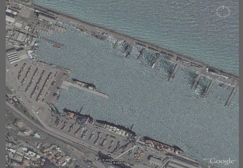
Haifa Harbor - DigitalGlobe Image from Google Earth (1:4,600)
Let's begin this comparison of shoreline accuracy by superimposing four shorelines onto a 1-meter resolution image of Haifa Harbor. Why Haifa? Just because I happened to be making a land-sea mask in this part of the world. My initial study focused on using NGA's Prototype Global Shorelines (PGS) created from Landsat ETM+ imagery. As you will read and see this global shoreline is one of the most detailed available. It does have a few negative considerations, like "stuttering" shorelines, non-mapping of water-inundated land (swamps, marshes, etc.) and hand-tracing of shorelines is more accurate than the software generated shorelines...but, that said, NGA PGS shoreline is a great first-step toward a global shoreline for all of us.
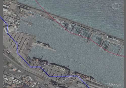
Haifa Harbor - 1:2,000,000 (Red) and 1:250,000 (Blue) (1:4,600)
The 1:2,000,000 (Red) shoreline is, by virtue of it's name, designed to be used at 1:2,000,000 or smaller resolutions. It works well for coarse shoreline delineation to get "an idea" of where the shore ends and the sea begins. The 1:250,000 goes by the acronym W(orld) V(ector) S(horelines). It was originally extracted from Tactical Pilotage Charts. It gives one a useful shoreline for a wide variety of projects. However, when one pushes it beyond 1:250,000 it quickly proves inaccurate in tracing the actual shoreline.
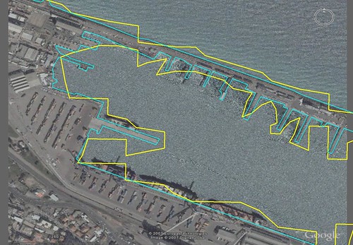
Haifa Harbor - NGA PGS (Yellow) and EEVS Precision (Lite Blue) (1:4,600)
Now for the good stuff! The NGA PGS precision shorelines do a fairly good job of tracking the actual shoreline. They are deemed appropriate at scales between 1:125,000 to 1:250,000. Some areas could be pushed to 1:62,500, but be careful. I am careful and I push them below 1:62,500, for digitizing purposes, in order to confirm my Landsat derived hand-made vectors are of greater precision than the PGS. And mine are! For the purposes of this comparison the PGS shorelines would give a person an accurate shoreline impression as long as it was not superimposed over the actual shoreline. The lite blue line is what I call E(xtremely) E(nhanced) V(ector) S(horelines). They are derived from DigitalGlobe's 1-meter resolution imagery found in Google Earth. Oh, that all the world were imaged at 1-meter cloud-free resolution. I feel that is a long way coming and I don't think the global shoreline vector files derived from them will be free. I suspect they will be quite costly.
Back to the land-sea mask, or what started this current study. The most accurate vector based global land-sea mask is mine. I call it GSHHS Derived Global Land-Sea Mask and you can download a copy here. Be forewarned, the file is 83.9MBs zipped and 340MBs unzipped.
The most accurate future global shoreline map should be the NGA PGS precision product, but it needs work to finish it (correct stutters, map non-mapped areas, etc.). Once it is finished, it will be THE GLOBAL SHORELINE. Until then, WVS rules.
Enjoy!
No comments:
Post a Comment