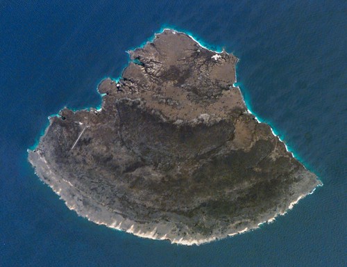
Isla Blanquilla - ISS015-E-7771 Image
A few days ago Earth Observatory carried this image of Isla Blanquilla and an interesting article about this small island located NE of Caracas Venezuela. Granted, if you are a US citizen, it is probably not your first choice to visit on a leisurely vacation due to the strained relations between our two countries, but the ISS image is pristine and details are mappable compared to the partially cloud-obscured Landsat ETM+ image. DigitalGlobe has never snapped a pic of this island either. So, I made do with the ISS image and created my map over a 4-hour period.
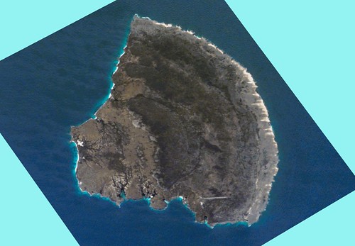
Isla Blanquilla - ISS015-E-7771 Georectified Image (1:62,500)
In order to use any non-georectified imagery, one must georectify it. I use Global Mapper to georectify. I loaded NGA PGS shorelines of this island (Region 14). These shorelines are very close to Landsat ETM+ shorelines. I selected 4 easily definable points on both my loaded shoreline line file and on my ISS image. It took about 10-minutes, with most of the time spent watching TV. Once the image was georectified, I began the task of digitizing the island shoreline, lower beach, upper beach, bare island, hi-low vegetation, airfield and the shallow reef surrounding the island.
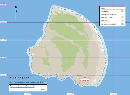
Isla Blanquilla - EVS Marplot Map (1:62,500)
Once the digitizing was completed, I imported the completed layers into Marplot, where I still do much of my preliminary map construction. I am just used to working with it. I defined each layer and assigned it to pre-existing EVS layers. I did a quick layout of map titles, legend, scale and north arrow. Done!
At this point, I typically post. One day when I am given the opportunity and the time, I will "fancy" up my map using ImageForge prior to posting. Until that day arrives, this is as good as it gets.
Enjoy!
No comments:
Post a Comment