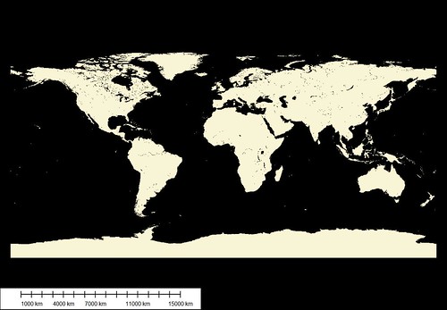
Global Land Mask using GSHHS Modified WVS
Regular readers know that I am a long time user of World Vector Shorelines (WVS). These vectors cover the world at a scale of 1:250,000. If you download them, you will see that they are not polygons, but line files. I have always wanted to create a land-mask of all land areas within this database, but have never had the time, software or computer calculating power. That was until yesterday. A reader asked if I knew whether their was a land-sea mask at better resolution then the 1-kilometer grid cell version currently available. To tell the truth, I didn't know about land-sea mask maps. After a brief search of some of my sources I found out that the main global land-sea mask was something build back in 1996 using WVS. Instead of using vectors as the deliverable, the builder fashioned the 1-kilometer grid map.
I let my reader know that the 1-kilometer global land-sea mask he currently was using was, probably, the best going. He knew of the Globcover LULC 300-meter grid cell version coming out in the first part of February 2008 to be created and made available by ESA.
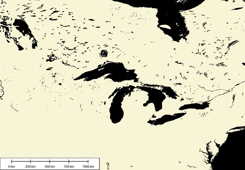
Global Land Mask - Eastern Canada and US
Curious soul that I am and having time, software and computer capabilities, I decided I would create my own global land mask. I loaded the land files taken from GSHHS, a modified version of WVS, into Global Mapper. Using a simple routine within the digitizing tools, I created polygons from lines. Simple process, but very long processing time. Eurasia took over 4-hours to process. After working at it all day and night, I came up with my vector version of a Global Land Mask. The entire file is 340MBs in size (84MBs zipped). It takes about 3-minutes to load into GM, but wow! It does look pretty cool.
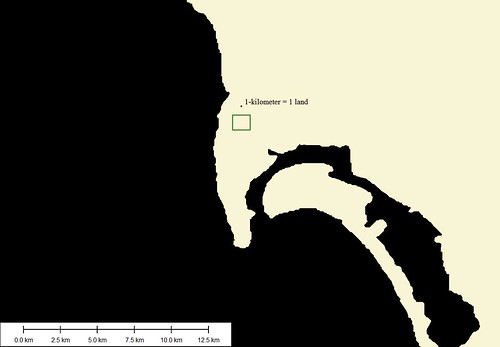
Global Land Mask - San Diego with 1-kilometer grid cell (1-125,000)
The above image is at a scale of 1:125,000 (1-inch to 2-miles). The 1-kilometer grid cell is placed on the map to give you an idea of the coarseness one gets using the existing global 1-kilometer grid-cell map. Even though it was derived from WVS vectors, not using the power of vectors (infinite zooming capabilities) one encounters an unnecessary coarseness not evident in the vector-based product.
I think my vector-based product is an example of a wonderful land-sea mask.
Enjoy!
No comments:
Post a Comment