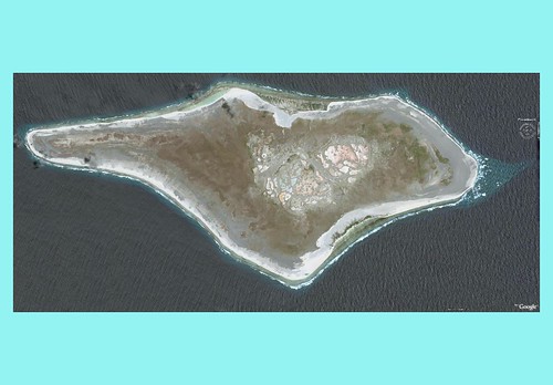
Starbuck Island - DigitalGlobe Image from Google Earth - 13 Tile Mosaic with Ocean Fill
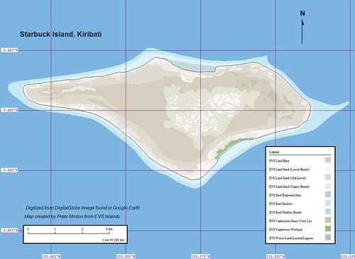
Starbuck Island - EEVS Precision Marplot Map (1:50,000)
This island was a challenge to digitize. Working off of my 13-tile Starbuck Island DIGM (DigitalGlobe Image Mosaic) and using Global Mapper digitizing tools, I spent Saturday, Sunday and Monday completing my map. The best view for this map comes from selecting it and looking at the full size image in my Flickr account. This map is a semi-fancy composition. To completely fancy this map would take another 2 to 4 hours and I wanted it posted instead of fancied.
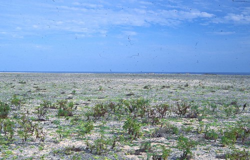
Starbuck Island's Interior (AKK 075, PBIF Photo)
I hope my map gives one the same message as this picture (see photo credits) of Starbuck Island's interior. The plants you see in the foreground are "sticker" bushes. This is a desert island. The location is such that it gets very little rainfall. But the little island continues - it is a tough little island.
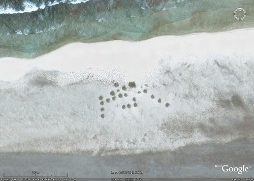
Starbuck Island - The Forest
Along the northwest shore is the Starbuck Island forest. It consists of 22 palm trees. I suspect that if these grow more will be planted.
Enjoy!
No comments:
Post a Comment