Bikini Atoll - LIIM N-58-10 (1:200,000)
I decided to digitize this atoll because the Landsat Island Image Mosaic is cloud-free and it has a certain amount of notiriety connected with nuclear weapons testing and population displacement. As a youngster, I watched rebroadcasts of one of the blasts on TV. It was probably the Bravo blast, the one that left the big hole in the northwest portion of the reef.
The islanders are still displaced. It seems they tried to reestablish themselves back in the 70's. After awhile they were beginning to glow (figuratively speaking). They were taken off of their home and scattered onto other islands. Now, tourists are allowed to visit, along with divers and fishermen. The island and it's waters have been deemed safe for short stays. Just don't drink the groundwater, eat the coconuts, land crabs or fish. One advantage if you stay for a long time - you won't need a lantern at night, your radioactive glow will provide sufficient illumination. Just a joke. I know that folks earning their livelihood from tourists, divers and fishermen will resent my "glow" remarks. I apologize to them. But, the U.S. military screwed up when they blasted holes in this atoll. 60-years later, I still say, "Shame on you."
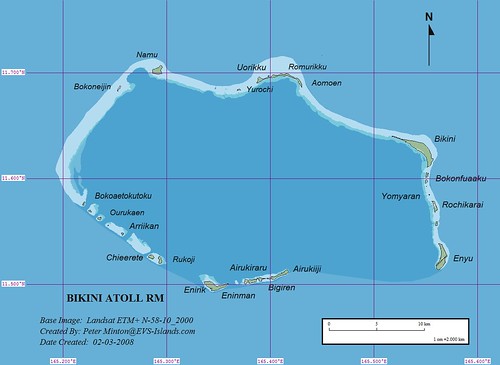
Bikini Atoll - EVS Precision Map (1:200,000)
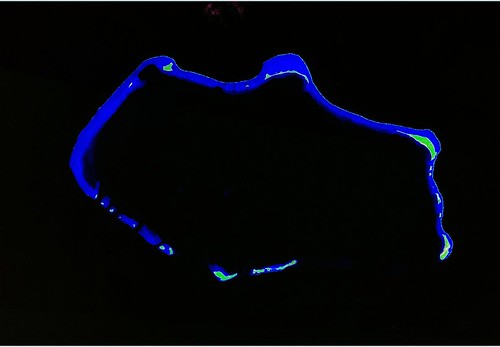
Enough about my personal gripes. The EVS precision map of Bikini Atoll was a fairly fast project to complete. The digitizing took 8-hours over a period of 2 days. The map assembly and posting has taken another 2-hours. 10-hours from start to finish for an island of this size is good. The reef, thank goodness, was relatively simple to digitize. Some reefs are quite complex and require many layers of information. This reef consists primarily of three layers - EVS Reef Shallow, EVS Reef Middle and EVS Reef Deep. They are distinguished by their respective shades of blue. The majority of the lagoon is classified as EVS Reef Deep. I used only a single vegetation layer, EVS Vegetation Mixed (Hi-Lo). I use this classification on most Landsat imaged islands with a mixture of palms and other trees along with shrubs and low-lying plants. When I am able to study a DigitalGlobe hi-res image along with the Landsat, I am able to make better vegetation layer classifications.
I still have work remaining on this project - EVS Reef Awash where visible waves appear along the outer reef and confirmation of individual motu names When I am satisfied with the outcome, I will repost the map. Until then...
Enjoy!
No comments:
Post a Comment