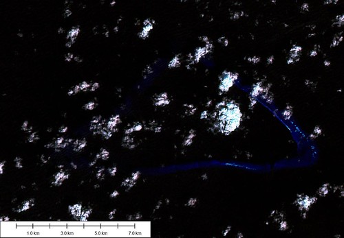
Kingman Reef - Landsat Image N-03-15_2000 (1-75,000)
Things can heat up at EVS Islands pretty fast, especially when National Geographic requests information about one of my mapping projects. Respected group that they are, they constantly research many areas prior to selecting a few primary areas for more thorough studies. One such area they are studying in depth is Kingman Reef. Since I have done mapping of the reef, one of their mapping team members contacted me and asked about my map of the reef. Needless to say, I was quite excited, yet apprehensive. I knew that the Landsat ETM+ imagery for this reef was not the most revealing. I remembered that in order to construct my EVS precision map I had to "trick" the image.
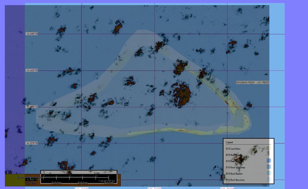
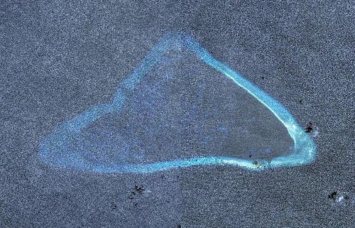
Kingman Reef - "Tricked" Landsat Image Over EVS Precision Marplot Map (1-75,000)
Using a Blend mode in Global Mapper that made the black colored sea transparent, the reef appeared as a murky yellow smudge. Using this yellow smudge to define the limits of the reef, I mapped it. Comparing my map to a nautical chart of the area, it turns out my EVS precision map of Kingman Reef is a solid effort. After numerous emails back and forth, I sent NGS my Kingman Reef vector files and various images to help them in their study of this reef.
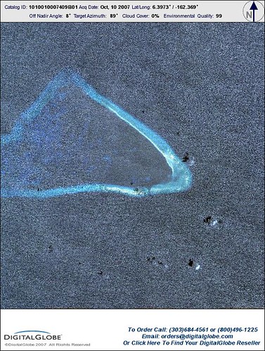
Kingman Reef 10007409B01
Kingman Reef 10007409B01
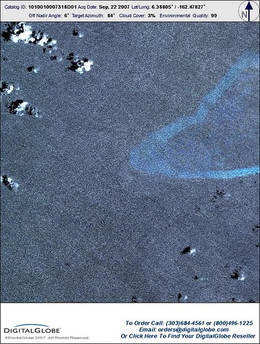
Kingman Reef - Combined Image (10007318D01 and 10007409B01)
Let's talk about a "perfect world" where we all have access to the best imagery. I should have used DigitalGlobe's exquisite imagery of Kingman Reef to construct my map. A quick scan of DigitalGlobe's available imagery covering Kingman Reef reveals two nearly cloud-free views of the reef. An equally quick "cut and paste" gives me a revealing view of the reef. I could have made the ultimate map for this reef using these two images.
Let's do a "what if". What if my original Kingman Reef project had been constructed from these two DigitalGlobe images? What if I could have told the NGS rep that they were getting the best map availabe for this particular reef, because it was constructed from the best available imagery? What if I could have emailed them a copy of DigitalGlobe's imagery and my vector files for Kingman Reef? What if they would use and credit DigitalGlobe's imagery and my map of Kingman Reef in a future article? I think that is called "win-win".
And let's end this post with a proposition - DigitalGlobe, what would it take for you to make EVS Islands your island imagery charity case? Do you need me to be a non-profit? That is what I intend to do with EVS Islands. If you give me access to your island image archives, I promise I will make the best island maps possible. Using your imagery, I will teach young people the fine art of map making. I promise not to get in the way of your ongoing operations. I will quietly access island images from your archive, construct island mosaics and continue to make the best island maps possible.
Come on, DigitalGlobe, let's make a deal!
No comments:
Post a Comment