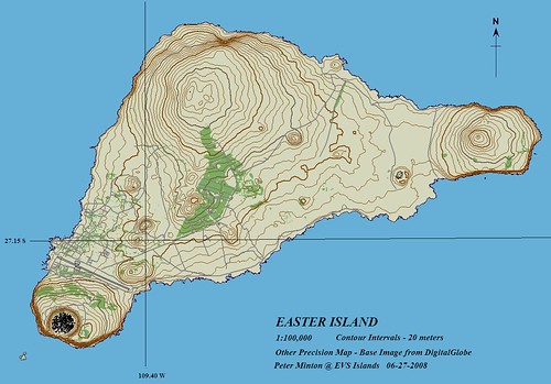
Easter Island - Other Precision Map (1:100,000)
Yep! Finally finished with this map. I have worked off and on on this map for a year. Back in August 2007 I completed everything but the water features in Rano Kau crater and modifying three minor contours (20-m, 40-m and 60-m). A few months back I got an email from a person wanting to use this map in a publication. That presented two problems. First problem, the map was constructed from DigitalGlobe imagery. First problem solved - I got in touch with my contact at DigitalGlobe and explained the problem. He got back to me with permission to use the map ensuring proper crediting took place. Second problem, had to finish the map. Second problem solved - I went back to work and finished the Rano Kau crater water features and finished modifying the minor contours. Problems solved and map will appear in this person's soon to be published book.
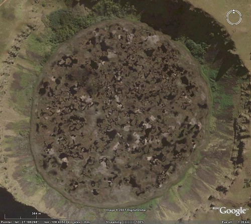
Rano Kau Crater - DigitalGlobe Image from Google Earth
Just thought I would share the DigitalGlobe imagery I used to complete the Rano Kau crater water features. After many hours of small water feature digitizing, I am here to tell you there are lots of little ponds and puddles at the bottom of this crater.
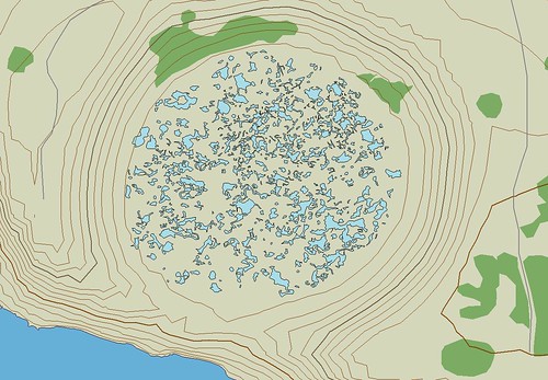
Easter Island - Other Precision Map (1:8,340) - Rano Kau Crater
After finishing, I am satisfied with my completed Easter Island map. Also, I am happy that my map will be used to make a person's book a better one.
No comments:
Post a Comment