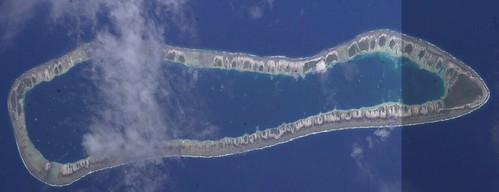
My mapping target for the night, Takume Atoll. The Landsat image, S-07-15_2000, looks pretty good. Clouds obscure the northern motus. So how does this intrepid mapper solve this digitizing problem.
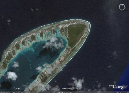
First, I checked out DigitalGlobe's imagery in Google Earth. The northern section of the atoll is covered with cloud-free hi-res imagery. Since I am looking to possibly explore commercial opportunities for my EVS precison island maps, DigitalGlobe imagery is a "no go".

I visited the Gateway to Astronaut Photography and poked around to see what imagery was available for this atoll. It turns out during the ISS006 mission, this atoll was photographed. I downloaded both photos and went about putting them together.
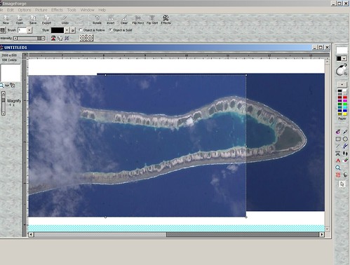
I pieced the two images together using Irfanview and ImageForge. I loaded the northern section first and placed the southern section on top of it. I had to do a small stretch to make the southern image fit onto the northern section.
I trimed the modified image and saved it. Now I have to tilt it at the proper angle to better georectify the image.
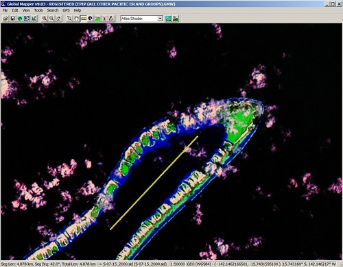
Using a measuring feature in Global Mapper, I was able to determine that the atoll is at a 42° angle. Now I needed to tilt the image 42°. Irfanview allowed me to tilt the image the requisite degrees.
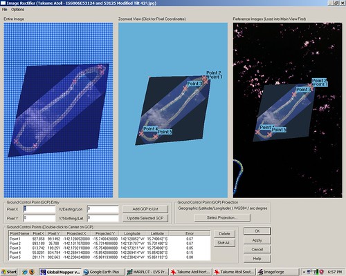
I used Global Mapper's georectifying module to georeference the tilted image. I selected a rectification routine called Triangulation which requires 5 GCPs. 3 GCPs were selected in the northern section and 2 GCPs were selected in the southern section.
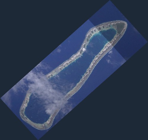
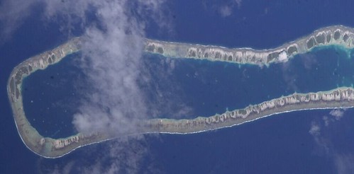
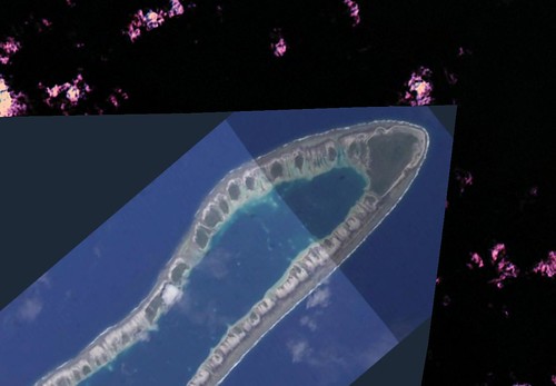
And there is the georectified Takume Atoll ISS image.
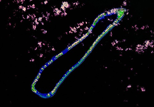
I used the ISS image to digitize the cloud covered northern motus. Once they were completed, I tricked the top image (ISS) to complete digitizing the balance of the atoll.
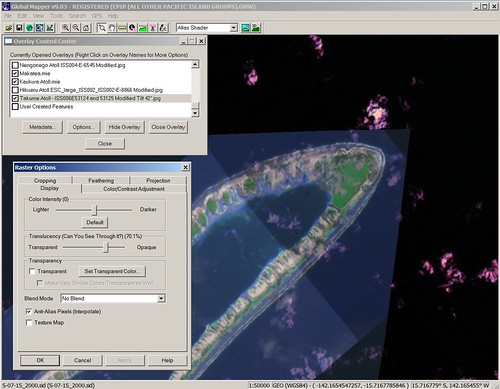
I used a translucency option and converted the ISS image to 70% translucency. This allows the underlying image, primarily their colors, to show through the top image. I used this setup to complete digitizing the remaining shorelines.
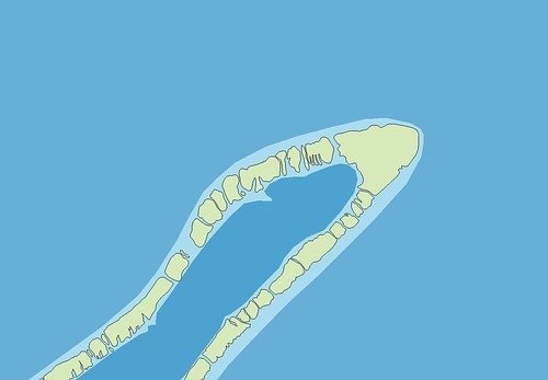
Here is the finished northern section of Takume Atoll. All of the cloud covered motus are mapped using ISS imagery. Pretty cool, huh?
Enjoy!
No comments:
Post a Comment