Hikueru Atoll - Google Maps
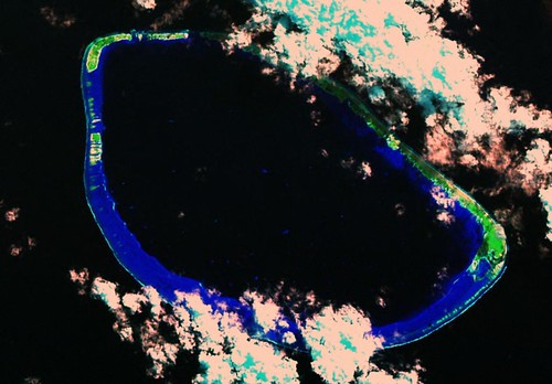
Hikueru Atoll - Landsat Image S-07-15_2000 (1:70,000)
There are times Landsat ETM+ island imagery is obscured by clouds. That is when I go to plan ISS or International Space Station imagery. One is not guaranteed that cloud free imagery will be available, but that is where I search for quality imagery.
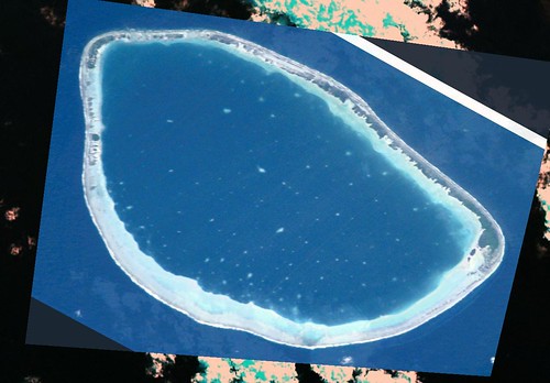
Hikueru Atoll - ISS Image ISS002-E-8866 (1:70,000)
In the case of Hikueru Atoll, ISS002 snapped some great cloud-free images of Tuamotu atolls. Hikueru Atoll is covered by the above image. Using the above two images I was able to create my finished map of Hikueru.
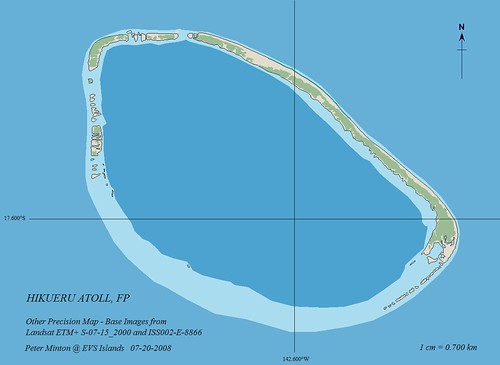
Hikueru Atoll - Other Precision Map (1:70,000)
This mapping is part of my on going effort to map the islands of the South Pacific at EVS Precision or better. Other Precision is always EVS Precision or better. The map was finished using Marplot mapping software.
Hikueru Atoll is covered by a brief article in Wikipedia. As of the 1988 census, 124 people live on Hikueru. They earn a living from copra, fishing and pearls. The atoll does have an airport, which can be seen in the ISS image, that was built in 2000.
Enjoy!
No comments:
Post a Comment