Mataiva Atoll - Google Maps
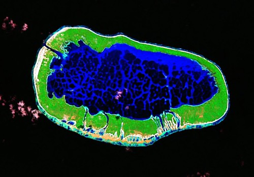
Mataiva Atoll - Landsat Image S-06-10_2000 (1:50,000)
I have looked at this atoll a few times and each time I decided to not digitize it. The reticulated lagoon represented many hours of digitizing. I knew the finished map would look great, but I just didn't want to do the work. Besides the lagoons near surface coral formations, the outer reef is raised and consequently much of it needed to be digitized into an island polygon layer. A challenge that I took up today. After four hours of digitizing and map composing, I'm finished.
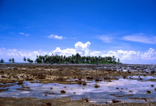
Mataiva Atoll - Raised Reef (WikiMedia Commons)
This photo shows the raised reef of Mataiva Atoll. In the distance is a smaller motu. It makes for a pretty picture, but a digitizing challenge.
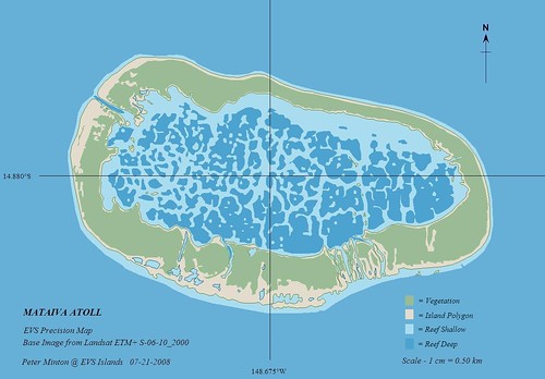
Mataiva Atoll - EVS Precision Map (1:50,000)
And here is the finished EVS Precision map. It is an attractive composition as well as an excellent depiction of the atoll.
Now for a little about this atoll and the inhabitants unwelcomed treasures - submerged phosphates. These deposits have been known for some time, but the inhabitants have resisted the mineral extraction of these deposits. Too many Pacific islands are a mess because phosphate extraction was vicisously pursued with little thought to the island's future. Hopefully, the inhabitants of Mataiva Atoll will continue their strong resolve to not exploit these submerged phosphate deposits.
Enjoy!
No comments:
Post a Comment