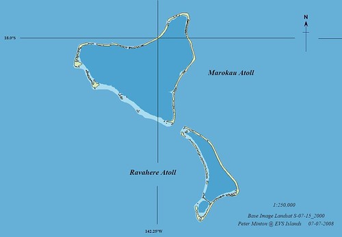
Marokau and Ravahere Atolls - EVS Precision Map (1:250,000)
I am mapping my way through the Tuamotus, with a goal of having EVS Precision maps for all islands located in the South Pacific. I finished mapping shorelines and reefs for Marokau and Ravahere Atolls. The atolls have a reported population of 50 plus. The folks make a living off of copra, fishing and pearling. The eastern edge of Marokau's long motu has a number of pools, most probably saltwater created from heavy surf during a storm. It sure does make one ponder the tenuous life lived on a 1 to 2 meter high atoll.
Interesting, but not the complete reason for sharing this post. Let's take a look at how the big three internet map moguls handled these tiny jewels.
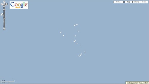
Marokau and Ravahere Atolls - Google Map (1:800,000)
Google Maps - Their shorelines are DCW (Digital Chart of the World). 1:1,000,000 is as good as it gets with Google Maps. Actually, the above map is at a scale of approximately 1:800,000. That was the closest I could zoom. I've had people tell me these maps are intended for routing and coarse direction finding. I think that is all one could hope for. DCW was a heck of a map during the infancy of the Internet. Now it is a mapping dinosaur, depicting shorelines with a very crude degree of detail.
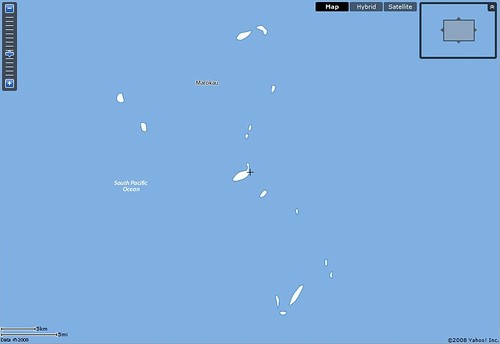
Marokau and Ravahere Atolls - Yahoo! Map (1:300,000)
At least Yahoo! lets us zoom in to approximately 1:300,000 scale. Their map also includes the atoll names. Nice touch, but still DCW shorelines.
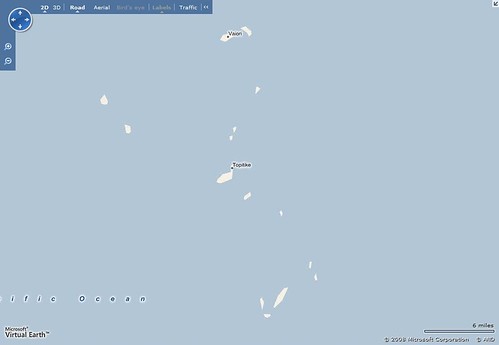
Almost ditto with Yahoo!'s map. MS Virtual Earth included the names of two villages found on these atolls. They neglected to include the names of the atolls, but we do have the villages named.
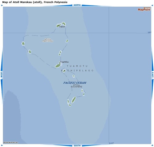
Marokau and Ravahere Atolls - MS MapPoint Map (1:400,000)
MS MapPoint can be found at a number of sites. It is an MS product that sells for between $250 to $70. At first glance, it looks to be a significant improvement over the DCW derived maps. However, it isn't. It is still a DCW derived map. The motus have a nifty blue ring around them and a reef feature ringing the atoll is identified. The reef feature is standard with any DCW country download. However the nifty blue rings around the motus looks to be a motu enhancer. The names are from NGA Country Files and the bathymetry is DCW standard issue.
This is the data world in action - take free government data, package it and sell it again and again! I acknowledge that TeleAtlas and Navteq should focus their mapping efforts on streets and roads within major cities. That is their cash cow. But to still be using DCW shorelines in many places throughout the world is silly. I'm sure that money dictates their every mapping decision. In this case, map quality should be the overwhelming determinant.
When my maps are consistently of far greater quality than Google, Yahoo! or MicroSoft or of their map providers, Teleatlas and Navteq, something is out of wack . . . and it isn't me and my maps. TeleAtlas and Navteq needs to spend a few bucks to upgrade their shorelines. WVS would be a significant upgrade over their current shorelines. For island shorelines, EVS precision vectors are the only way to go.
Enjoy!
No comments:
Post a Comment