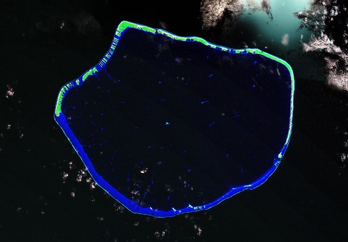
Arutua Atoll FP - Base Image From Landsat S-06-15_2000 (1:170,000)
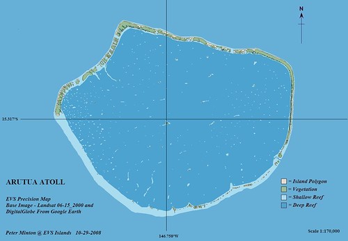
Arutua Atoll FP - EVS Precision Map From Landsat S-06-15_2000 (1:170,000)
According to a Wikipedia entry, Arutua Atoll has a population of 500 with the majority living in Rautini Village. These hearty souls earn their living off of copra, fishing and pearling.They do have a small airfield located on their island.
Let's talk about what went into the construction of this map. I worked in excess of 12-hours on this map over a period of 4-days. The excessive amount of time devoted to this project had to do with the size of the atoll (31-km by 24-km). This map consists of 812 unique features. The majority of these unique features are motus (small island polygons) and coral heads within the lagoon. The trick to digitizing this atoll is determination, patience and cloud-free imagery. I initially worked off of the Landsat ETM+ mosaic, digitizing at scales between 1:25,000 to 1:12,5000. The digitizing process was tedious and tiring, but the final map looks great.
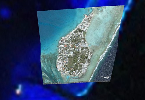
Arutua Atoll FP - Rautini Village From DigitalGlobe Image (1:6,800)
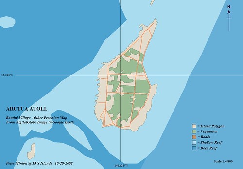
Arutua Atoll FP - Rautini Village in Other Precision Map From DigitalGlobe Image (1:6800)
Just for the fun of it, I digitized Rautini village using a DigitalGlobe image from Google Earth as my base image. The village took about 2-hours to complete. I added the road layer as a bonus feature.
All in all, I am pleased with this series of maps and I hope you find them interesting.
Enjoy!
No comments:
Post a Comment