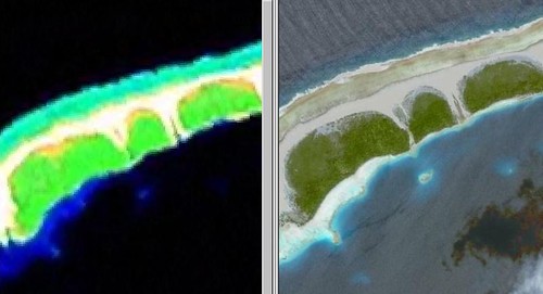
Landsat ETM+ and DigitalGlobe from Google Earth (1:18,000)
I have heard from many readers that maps derived from 14.5-meter resolution are useable between 1:125,000 to 1:62,500. To push them down to scales below 1:62,500 would render the map virtually useless.
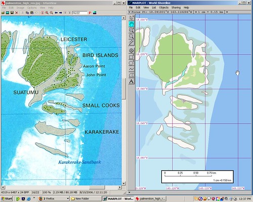
Palmerston Atoll - Bird Islands (1:15,000)
That was before I discovered a LINZ produced map of Palmerston Atoll at a scale of 1:25,000. My EVS precision shoreline was a very close approximation of the LINZ product. It was so similar that it was as if LINZ might have used the 14.5-meter resolution imagery to produce their island map. I asked them and never got a satisfactory answer. My guess is that they did make use of the 14.5-meter imagery to produce their 1:25,000 scale map. Just a guess, but a good one.
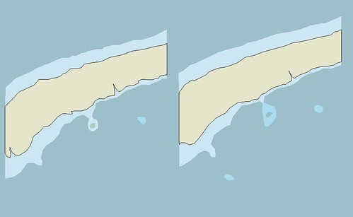
EVS Precision and EEVS Precision Shorelines with Reefs (1:18,000)
Using the first image in Global Mapper, I digitized both shorelines at 14.5-meter resolution and 1-meter resolution. The left map (less vegetation layers) was created from 14.5-meter imagery. The map on the right was created from 1-meter imagery. I am certain DigitalGlobe's 1-meter imagery is the best hi-res imagery currently available, thanks to Google Earth. I confidently acknowledge that shorelines, reefs, vegetations layers and other layers of information derived from 14.5-meter resolution imagery is good mapping information. As with any imagery, one needs to make mapping compromises. Perfection at tracing a dynamically shifting shoreline is impossible. Tha shoreline's ultimate delineation can be approximated, at best. My EVS precision work allows me to create and use mapping products at scales far below 1:62,500 - like 1:25,000.
Enjoy!
No comments:
Post a Comment