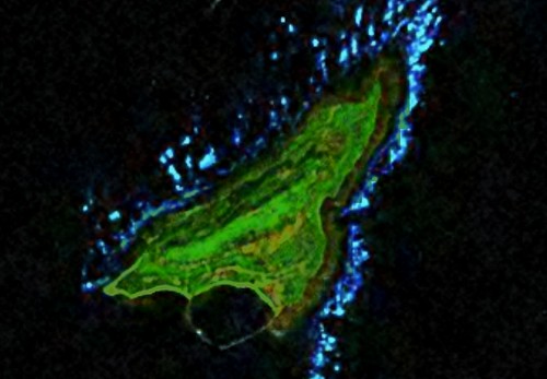
Dao Bach Long Vi - Landsat Image N-48-20_2000 (1-17,500)
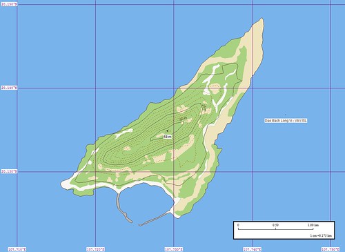
Dao Bach Long Vi - Marplot Map (1-17,500)
I haven't posted one of these in a long time. It is an Enhanced Vector Shoreline of a Vietnamese island. It seems that I posted this before, but I'll be darned if I can find it on my site. Oh, well.
Dao Bach Long Vi is a potential Marine Protected Area. For now, it is home to a lighthouse and a small population of fishermen. There are a series of photos posted in Google Earth that show interesting views of places about this island. It is home to military, fishermen and an occasional tourist.
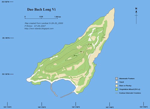
Dao Bach Long Vi - Marplot Map (1:17,500) - A Fancy Map
Yes siree, this is a fancy map. I took my original map, less lat/lon and scale box, and worked it over in my free paint program, ImageForge. I am still experimenting with fonts and text (credits and such), but the overall composition looks good. It took an extra two-hours to complete this project, but it is well worth it.
Enjoy!
No comments:
Post a Comment