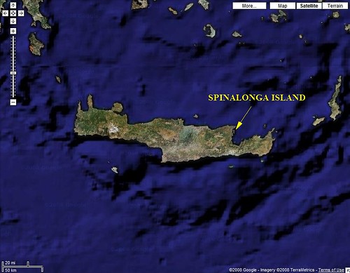
Spinalonga Island - Locator Map
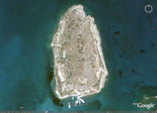
Spinalonga Island Crete - DigitalGlobe Image from Google Earth (1:3,500)
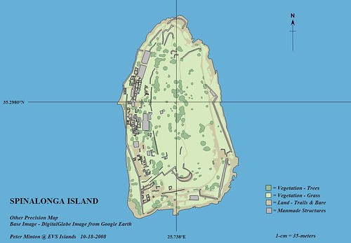
Spinalonga Island Crete - Other Precision Map - DigitalGlobe Image from Google Earth (1:3,500)
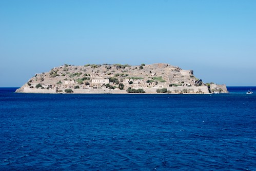
Once the site of a Venetian fortress built to protect the harbor to the southwest. For decades this fortress turned away invading forces, pirates and unwelcomed visitors. As happens to all fortresses, this one was ultimately overrun and then abandoned. For years this small island was home to no one. At the turn of the last century the island was reinhabited. From 1903 to 1957 the island's guests were lepers. Where other inhabitants had abandoned Spinalonga for new homes, these poor souls were abandoned to the island, outcasts from society. Those of you interested can find an article about Spinalonga Island on Wikipedia. Now days the island is a popular tourist destination. I'm not sure it would be high up on my list of "sites to see" as I travel about the Greek islands. But, everyone to their own desires.
Spinalonga Island - Looking at it from west to east.
I worked off of the DigitalGlobe image taken from Google Earth to create my Other Precision map of Sinalonga Island. As the island is quite small, the 1-meter resolution imagery allowed for a detailed study of the island to include remains of the fortress and the leper colony. The mapping took about 3-hours from start to finish.
Enjoy!
No comments:
Post a Comment