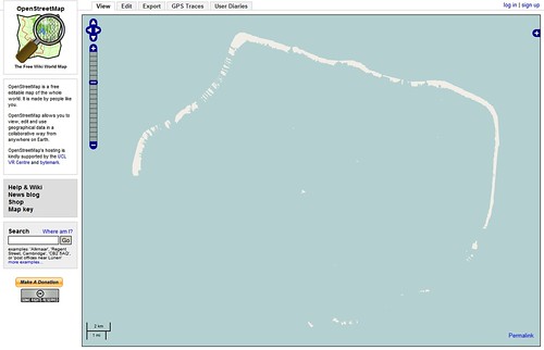
OpenStreetMap - Arutua Atoll - NGA PGS Shoreline Map
I've been making EVS Precision island maps for well over three years. Using Landsat ETM+ imagery as my base image from which I have created most of my 10,000 plus island polygons. All of my island maps currently reside on my E-Drive and on my I-Drive. Lots of islands doing few people any good. About three weeks ago a person from Google contacted me and wanted to discuss EVS Islands. I continue to hold out hope that my EVS Precision island maps will be licensed by one of the big three map folks. So far, I still have the 10,000 islands on my computer.
A number of readers have suggested I upload my island map files into OpenStreetMap. I have resisted the suggestion. I keep thinking that someone will want to pay me a fee to use my island maps.
The question I pose to my knowledgeable readers, "Who owns my map files if they are posted to OpenStreetMap? Do I continue to own them? Could I sell them to another user, yet still keep them on OpenStreetMap?
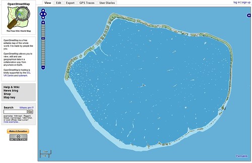
OpenStreetMap - Arutua Atoll - EVS Precision Map
If EVS Precision island maps were posted to OpenStreetMap this is what the user could view. That is if all four to five layers of information were included. I would suggest an ocean color change. My ocean blue looks a lot better than OSM's puke green color.
Depending on the answers to my previously posed questions will help me to determine whether I should post my EVS Precision island maps. Any answers?
Enjoy!
No comments:
Post a Comment