Ahe Atoll
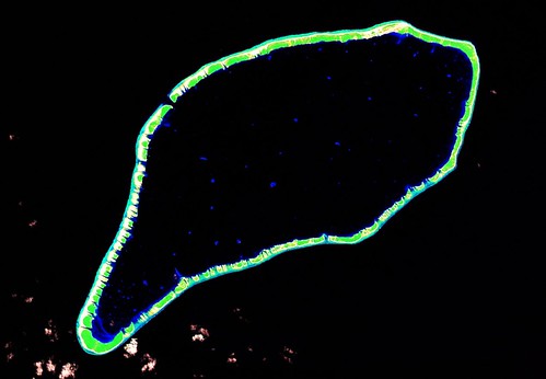
Ahe Atoll - Landsat Image S-06-10_2000 (1:100,000)
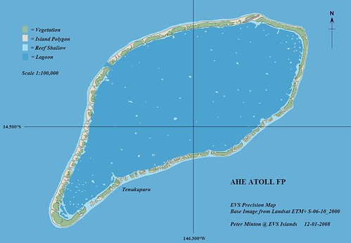
Ahe Atoll - EVS Precision Map (1:100,000)
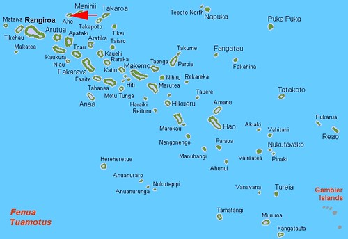
Ahe Atoll occupies a favorable position within the Tuamotus. It would be a potential first landfall for sailors departing from Hawaii heading south. The atoll has a single village with a population of approximately 100 hearty souls. The other 300 plus inhabitants live on the many small motus ringing the atoll's lagoon. Primary sources of income are black pearl farming and tourism, to a lesser degree.
If you followed the above link to Wikipedia, you will notice that the article has not been modified with my island article changes. I have been too busy. Give me a day or so and I'll make the changes to the Ahe Atoll Wikipedia article.
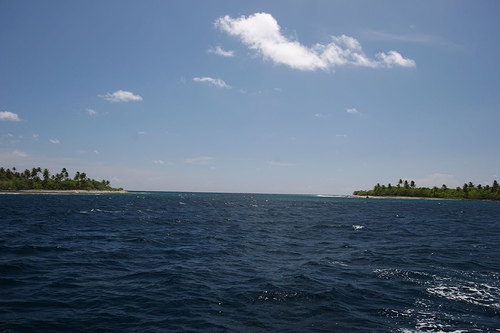
Ahe Atoll - Lagoon Entrance
My complements to Ekrem Inoru and his excellent set of photos detailing Ahe Atoll. I have included one photo from Ekrem's Ahe Atoll set showing the entrance to Ahe lagoon. Ekrem states that there is an 8-knot flow at lagoon entrance. This would be a challenge as tides flow in or out of the lagoon. Have a look at the entire set of Ekrem's Ahe Atoll photos found at Flickr. Just follow the link.
Enjoy!
No comments:
Post a Comment