Tematangi Atoll
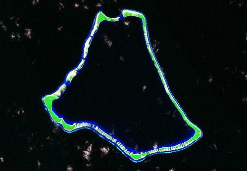
Tematangi Atoll - Landsat Image S-07-20_2000 (1:70,000)
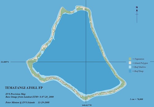
Tematangi Atoll - EVS Precision Map (1:70,000)
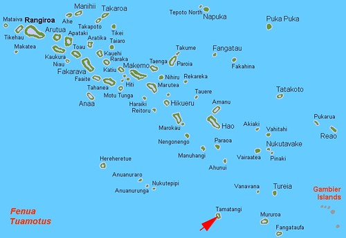
Tematangi Atoll is located at the southern end of the Tuamotus. I've posted an article dealing with this atoll previously. This post contains a redo of my original map and a locator map.
This atoll is of interest to Muslims as the antipode of the Qibla is about 50-kms NW. At this precise position one could face any direction and still be facing the Qibla.
I hope you find the reworked map useful.
Enjoy!
No comments:
Post a Comment